Login
Star users
Poll
Home
>
Australia
>
Western Australia
>
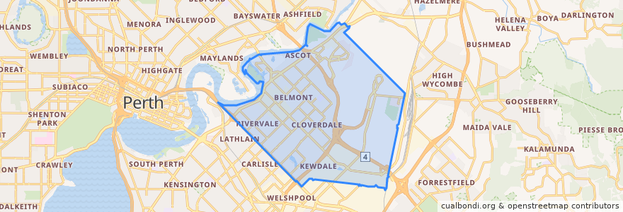
City of Belmont
City Of Belmont
See in interactive map
Routes of public transport
270F Elizabeth Quay Bus Station → High Wycombe Station
270T High Wycombe Station → Elizabeth Quay Bus Station
292F Redcliffe Station → Redcliffe Station
293F Redcliffe → High Wycombe
293T High Wycombe → Redcliffe
294F High Wycombe → Foodbank WA
294T Foodbank WA → High Wycombe
37F Oats Street Station → Airport Central Station
37T Airport Central Station → Oats Street Station
38F Perth Busport → Cloverdale
38T Cloverdale → Perth Busport
43F Elizabeth Quay Bus Station → Maylands
43FN Elizabeth Quay Bus Station → Maylands
43T Maylands → Elizabeth Quay Bus Station
43TN Maylands → Elizabeth Quay Bus Station
940F Elizabeth Quay Bus Station → Redcliffe Station
940T Redcliffe Station → Elizabeth Quay Bus Station
Airport Line: Claremont → High Wycombe
Airport Line: High Wycombe → Claremont
Stops
Belgravia Street after Great Eastern Highway
Abbott Road after Grogan Road
Redcliffe Station Stand 7
Abernethy Road after Alexander Road
Belgravia Street after Gabriel Street
Kew Street after Belgravia Street
Great Eastern Highway after Hardey Road
Abernethy Road after Kew Street
Abernethy Road after Noble Street
Abernethy Road after Gabriel Street
Kewdale Road before Ferguson Street
Great Eastern Highway after Toorak Road
Belgravia Street after Frederick Street
Gabriel Street after Gabriel Place
Stanton Road after Epsom Avenue
Clarkson Road after Tranby Road
Belgravia Street before Great Eastern Highway
Belmont Avenue after Gild Street
Epsom Avenue after Great Eastern Highway
Gabriel Street before Acton Avenue
Oats Street after Wheatley Street
Horrie Miller Drive after Reid Road
Belmont Avenue before Alexander Road
Great Eastern Highway before Toorak Road
Great Eastern Highway before Epsom Avenue
Airport Drive Stand 1
Great Eastern Highway after Acton Street
Stanton Road before Manuel Crescent
Abernethy Road before Beverley Road
Redcliffe Station Stand 4
Points of interest
City of Belmont