Login
Star users
Poll
Home
>
Australia
>
Victoria
>
City of Wyndham
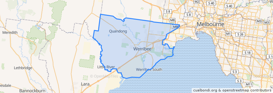
City Of Wyndham
See in interactive map
Routes of public transport
Bus 400: Laverton Station => Robinsons Road => Sunshine Station
Bus 400: Sunshine Station => Robinsons Road => Laverton Station
Bus 471: Sunshine => Altona Gate SC & Newport => Williamstown
Bus 471: Williamstown => Newport & Altona Gate SC => Sunshine
Bus SkyBus: Avalon Airport (AVV) => Melbourne (Southern Cross Station)
Bus SkyBus: Melbourne (Southern Cross Station) => Avalon Airport (AVV)
Flinders Street => Werribee (express North Melbourne => Footscray => Newport => Laverton)
Frankston => Werribee
Melbourne (Southern Cross Station) - Mildura
Mildura - Melbourne (Southern Cross Station)
Werribee => Flinders Street (express Laverton => Newport => Footscray => North Melbourne)
Werribee => Frankston
Stops
Aircraft Station
Williams Landing Station
Hoppers Crossing Station
144.7704291, -37.858650700000005
Hoppers Crossing Station
Williams Landing Station
144.66432170000002, -37.901143100000006
Werribee Station
Aircraft Station
Points of interest
Australia Post
Student Lounge
Caltex - Diesel only
McDonald's
KFC
Equine Centre
Michael's Fish & Chips
Morris + Heath
Hungry Jacks
Caltex
Silver Chopsticks
Roitleys
Student Kitchen
The Phoenix Hotel
Wyndham Library Service - Werribee Branch
Vending Machine
Driking Fountain
Caltex
City of Wyndham
Nando's
Caltex
Cold Rock Ice Creamery
Pirate Pizza
Wyndham Community & Education Centre
Phoenix
Ampol
Telstra Payphone
Moka
Werribee Police Station
Pizza Hut