Login
Star users
Poll
Home
>
Australia
>
Victoria
>
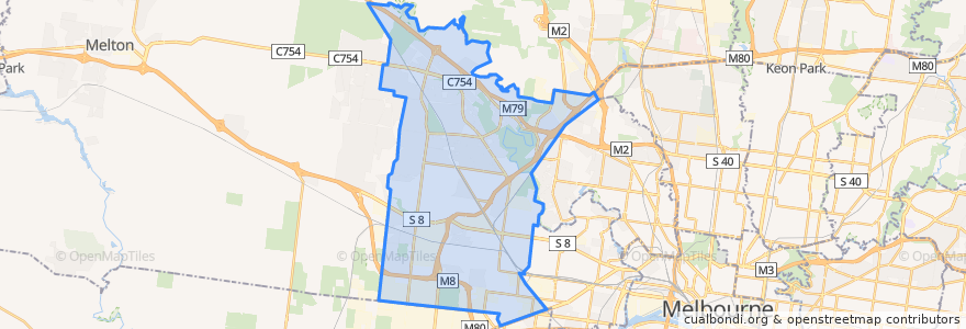
City of Brimbank
City Of Brimbank
See in interactive map
Routes of public transport
Bus 216: City (Queen Street) => Dynon Road => Sunshine Station
Bus 216: Sunshine Station => Dynon Road => City (Queen Street)
Bus 220: City (Queen Street) => Footscray Road => Sunshine Station
Bus 220: Sunshine Station => Footscray Road => City (Queen Street)
Bus 400: Laverton Station => Robinsons Road => Sunshine Station
Bus 400: Sunshine Station => Robinsons Road => Laverton Station
Bus 408: Highpoint Shopping Centre => Sunshine Station => St Albans Station
Bus 408: St Albans Station => Sunshine Station => Highpoint Shopping Centre
Bus 418: Caroline Springs => Keilor Plains Station => St Albans Station
Bus 418: St Albans Station => Keilor Plains Station => Caroline Springs
Bus 419: St Albans Station => Keilor Downs => Watergardens Station
Bus 419: Watergardens Station => Keilor Downs => St Albans Station
Bus 421: St Albans Station => Keilor Plains Station => Watergardens Station
Bus 421: Watergardens Station => Keilor Plains Station => St Albans Station
Bus 425: St Albans Station => Delahey => Watergardens Station
Bus 425: Watergardens Station => Delahey => St Albans Station
Bus 426: Caroline Springs => Sunshine Station
Bus 426: Sunshine Station => Caroline Springs
Bus 429: Sunshine Station => Sunshine South => Sunshine Station
Bus 456: Melton => Caroline Springs => Sunshine Station
Bus 456: Sunshine Station => Caroline Springs => Melton
Bus 463: Hillside => Langmore Drive => Watergardens Station
Bus 463: Watergardens Station => Langmore Drive => Hillside
Bus 469: Keilor East => Strathmore => Moonee Ponds
Bus 469: Moonee Ponds => Strathmore => Keilor East
Bus 471: Sunshine => Altona Gate SC & Newport => Williamstown
Bus 471: Williamstown => Newport & Altona Gate SC => Sunshine
Bus 476: Moonee Ponds => Watergardens
Bus 476: Watergardens => Moonee Ponds
Bus 477: Moonee Ponds => Essendon & Airport West & Gladstone Park => Broadmeadows Station
Bus 478: Airport West Shopping Centre => Melrose Drive => Melbourne Airport
Bus 479: Airport West Shopping Centre => Melbourne Airport => Sunbury Station
Bus 482: Airport West Shopping Centre => South Centre Road => Melbourne Airport
Bus 482: Melbourne Airport => South Centre Road => Airport West Shopping Centre
Bus 490: Airport West Shopping Centre => Gowanbrae
Bus 902: Airport West Shopping Centre => Chelsea railway station
Bus 903: Altona railway station → Mordialloc Shopping Centre
Bus 903: Mordialloc Shopping Centre → Altona railway station
Bus 959: City (Queen Street) => Niddrie & Airport West => Broadmeadows Station
Melbourne (Southern Cross Station) - Mildura
Mildura - Melbourne (Southern Cross Station)
Sunbury Line
Sunbury Line
Stops
Sunshine
Melton Highway/Parmelia Drive
St Albans Station (Bay 2)
Flora Street/Old Calder Highway
Borrell Street/Old Calder Highway
Watergardens
Petrik Drive/Old Calder Highway
Swan Street/Fosters Road
Rutherglen Way/Sunshine Avenue
Sunshine Station (Bay 13)
Knighton Avenue/Fullarton Road
Augustines Way/Old Calder Highway
Knighton Avenue/Fullarton Road
Swan Street/Fosters Road
Swan Street/Erebus Street
Ginifer
Kings Road/Melton Highway
Pindari Avenue/Apollo Road
Newell Close/Wellesley Drive
Keilor Cemetery/Ely Court
Sunshine Station (Bay 4)
Burrowye Crescent/Old Calder Highway
St Albans
Wanaka Drive/Sunshine Avenue
Watergardens Shopping Centre/Watergardens Circuit Road
Cocoparra Crescent/Apollo Road
Chichester Drive/Apollo Road
Pindari Avenue/Apollo Road
Swan Street/Erebus Street
Fastnet Drive/Parmelia Drive
Points of interest
Western Rolls
Hunky Dory
Ruby's Cafe
Nando's
Chemist Warehouse
Advance Healthcare
Commonwealth Bank
Village Cinemas
Old Man Pho
Sunshine Smiles Dental Clinic
Sunshine Library
NAB
Bubble Cup
Subway
Sunshine Station
Sunshine City Club
Perth Avenue Fish & Chips
Treadwell Radiology
Thien Nhi
Red Rooster
Dim Tu Tac
Overnewton Castle
Le’s Furlong Pharmacy
Keilor LPO
Thai Alley
7-Eleven
Vũ Gia
Diamond Palace
Chùa Bồ Đề
Grill'd