Login
Star users
Poll
Home
>
United States
>
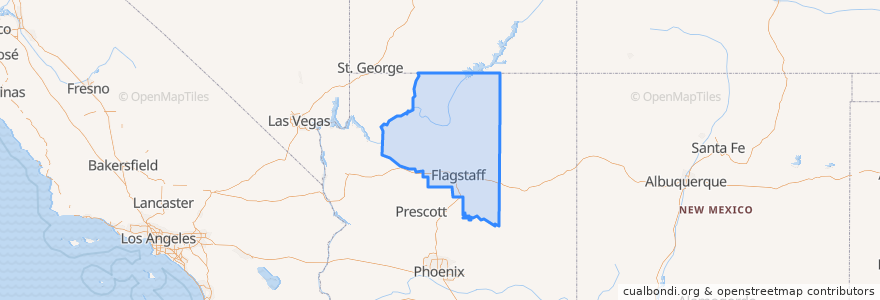
Arizona
>
Coconino County
Coconino County
See in interactive map
Routes of public transport
Bus VL: Cottonwood => Sedona
Grand Canyon Railway
Hermits Rest Route (East-bound)
Hermits Rest Route (West-bound)
Kaibab/Rim Route (East-bound)
Kaibab/Rim Route (West-bound)
Tusayan Route (North-bound)
Tusayan Route (South-bound)
Village Route (East-bound)
Village Route (West-bound)
Places
Grand Canyon Village
(9)
Tusayan
(3)
Williams
(1)
Cameron
(0)
Flagstaff
(0)
Fredonia
(0)
Kaibito
(0)
LeChee
(0)
Leupp
(0)
Moenkopi
(0)
Munds Park
(0)
Page
(0)
Parks
(0)
Supai
(0)
Tonalea
(0)
Tuba City
(0)
Winslow West
(0)
Stops
-112.12652390000001, 35.973131
-112.12778610000001, 35.970377500000005
Tlaquepaque
Grand Canyon Visitor Center
Big E Steakhouse & Saloon
Village Route Transfer
-112.1472191, 36.061775000000004
Best Western Grand Canyon Squire Inn
-112.1660937, 36.071219400000004
Pipe Creek Vista
Powell Point
Hermits Rest
Mather Point
-112.14831670000001, 36.070348700000004
-112.18276110000001, 36.0604968
Flag Stop (Morgan Rd.)
-112.10847120000001, 36.0580374
-112.14404420000001, 36.056951500000004
IMAX/R.P.'s Stage Stop
Mojave Point
Grand Hotel
Shrine of the Ages Eastbound
Maricopa Point
Hillside Shops & Galleries (Arabella)
Market Plaza Westbound
Sedona Municipal Parking Lot
Yaki Point
Hopi Point
-112.11530490000001, 36.0528895
Monument Creek Vista
Points of interest
Cruiser's Route 66 Cafe
Starbucks
Sage Loop Campfire Circle
McKee Amphitheater
Parks
Leupp
Cream & Cake Couture
Bloom dispensary
Yavapai Cafeteria
Harvey House Café
Maswik Cafeteria
Texaco
Kaibito
Munds Park
Williams Police Department
Oregano's Pizza Bistro
The Grand Canyon Winery
Theia's Cafe
Moenkopi
We Cook Pizza & Pasta
Texaco
Starbucks
Creekside
Baskin-Robbins
Starbucks
El Tovar Dining Room
Pancho McGillicuddy's
Grand Canyon Village
Bright Angel Restaurant
Javelina Cantina