Login
Star users
Poll
Home
>
Yuba County
>
Marysville Loop (Counter Clockwise)
Route
Marysville Loop (Counter Clockwise)
write the first review
Places that travel to
Marysville
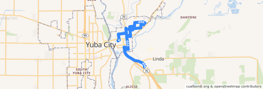
See in interactive map
Points of interest near the route
Bok Kai Temple
Saint Johns Episcopal Church
Mount Olivet Baptist Church
Domino's Pizza
First Christian Church
Yuba County Courthouse
Saint Joseph Catholic Church
Marysville
Arco
Notre Dame Convent
First Presbyterian Church
Marysville Post Office
C Stop
Marysville City Hall
Marysville High School
Covillaud Elementary School
Yuba County Jail
Hall Street Baptist Church
Veterans Memorial Auditorium
Peach Tree Clinic
Popeyes
Peach Tree
McKenney Intermediate School
Faith Lutheran Church
Taco Bell
Kynoch Elementary School
Zion Church in Jesus Christ Number 2
Buddhist Church of Marysville
Family Bible Center
Hilltop Donut Shop
Burger King
Yuba County Library
Marysville Fire Department
First Methodist Church
Agape Bible Church
Packard Library
Stops:
Ramirez Street and East 18th Street
H Street and 11th Street
22nd Street and Covillaud Street
Peach Tree Clinic (Department)
East 19th Street and Covillaud Street
North Beale Road and Wal-Mart
Ramirez Street and East 12th Street
Sampson Street and East 16th Street
H Street and 11th Street
North Beale Road and Wal-Mart
East 17th Street and Huston Street
Hall Street and East 19th Street
Peach Tree Clinic (Department)
Yuba Street and 12th Street (One-Stop)
H Street and 14th Street
Yuba Co. Government Center and I & 9th Streets
B Street and 3rd Street
Ramirez Street and East 18th Street
B Street and 3rd Street
B Street and 16th Street
B Street and 6th Street
Ramirez Street and East 15th Street
Yuba Co. Government Center and I & 9th Streets
Yuba Street and 12th Street (One-Stop)
H Street and 14th Street
Ramirez Street and East 15th Street
B Street and 8th Street (Caltrans)
Sampson Street and East 16th Street
East 19th Street and Sampson Street
East 17th Street and Covillaud Street
East 19th Street and Covillaud Street
B Street and 8th Street (Caltrans)
D and 2nd
Hansen St. and East 22nd St.
North Beale Road and Rio Rancho Motel
B Street and 16th Street
Hansen St. and East 22nd St.
East 17th Street and Huston Street
North Beale Road and Rio Rancho Motel
22nd Street and Huston Street
East 17th Street and Del Pero Street
22nd Street and Covillaud Street
Ramirez Street and East 11th Street
Hall Street and East 19th Street
14th Street and Ellis Lake Drive
Ramirez Street and East 12th Street
East 17th Street and Del Pero Street
Ramirez Street and East 11th Street
B Street and 6th Street
East 19th Street and Sampson Street
Chestnut and East 18th Street
Chestnut and East 18th Street
14th Street and Ellis Lake Drive
East 17th Street and Covillaud Street
D and 2nd
22nd Street and Huston Street