Login
Star users
Poll
Home
>
Maryland
>
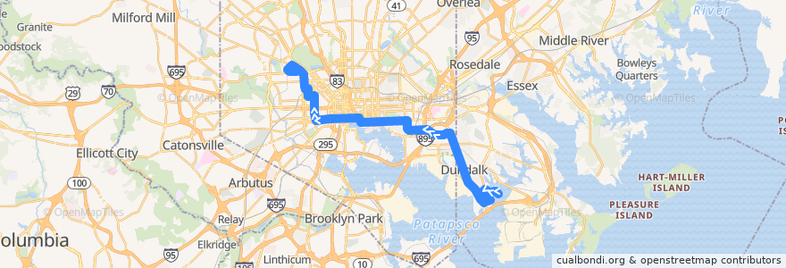
CityLink Navy: Mondawmin Metro Station
Route
CityLink Navy: Mondawmin Metro Station
write the first review
See in interactive map
Points of interest near the route
Tin Roof
Rite Aid
Lears II
Kislings Tavern
Church of God at Dundalk
The Vue Condominium
Bagby Pizza Co.
Squire's
Unos
Ritz Caberet
Starbucks
Flemings
Huck's American Craft
Starbucks
The Black Olive
Potbelly
Captain James Landing
Star of Bethlehem Spiritual Temple
Baltimore Arena Parking Garage
Nando's Peri-Peri
Greater Olivet Baptist Church
USPS
Harbor East Deli
Roll Ice Cream & Coffee
McDonald's
LabCorp
O'Donnell's Pub & Grill
New Bethlehem Baptist Church
Subway
Lexington Pharmacy
Hustler Club
Patterson Station Baltimore Post Office
Maryland Transit Administration Police Force
Pierpoint Restaurant
Starbucks
Rx Pharmacy
Southwest Baptist Church
Sacred Heart of Mary School
Baltimore Taphouse
Fayette Health and Rehabilitation Center
Cardinal Tavern
Kaiser Permanente
Howl at the Moon
Charm City Veterinary Hospitial
Tutti Gusti
The Gallery at Harborplace
Mayuree Thai Tavern
Saint Lukes Episcopal Church
Woody's Rum Bar and Island Grill
Jabali Brewing Co.
The Obedience Church of God
Luna del Sea Bistro
M&T Bank
American Radiology
The Laughing Pint
The Chasseur
8 Ball Meatball
JD's Smokehouse
Sollers Point Branch - Baltimore County Public Library
Nicodemus Baptist Church
Stops:
-76.5698126, 39.2865176
-76.57135170000001, 39.2864615
-76.5688702, 39.2865538
Mondawmin
-76.5688757, 39.286619300000005
-76.57565430000001, 39.2863526
Liberty Heights Avenue & Mondawmin Entrance Southbound
-76.52340980000001, 39.256753200000006
Eastern Avenue & East Avenue Westbound
Tioga Parkway & Forest Park Avenue Eastbound
Fulton Avenue & North Avenue Northbound
Tioga Parkway & Forest Park Avenue Eastbound
Liberty Heights Avenue & Mondawmin Entrance Southbound
Fulton Avenue & Clifton Avenue Northbound
Mondawmin
Reisterstown Road & Ruskin Avenue Northbound
Fulton Avenue & Clifton Avenue Northbound
Fulton Avenue & North Avenue Northbound
Reisterstown Road & Ruskin Avenue Northbound
-76.5232955, 39.2567819
-76.5698078, 39.2865808
-76.5756479, 39.2862914