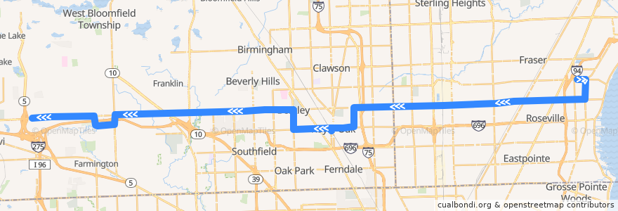
Route 740 WB: Roseville => Haggerty
Places that travel to
Points of interest near the route
Stops:
- Campbell / Gardenia (SB)
- -83.183566, 42.4937015
- -83.31049110000001, 42.5004873
- 11 Mile / Wyoming (WB)
- 12 Mile / Warren Mott (WB)
- Harper / Garfield (SB)
- 12 Mile / Utica (WB)
- 12 Mile / White Plains (WB)
- -82.99241710000001, 42.5074963
- 12 Mile / WSU Oakland (WB)
- -83.04742420000001, 42.5062159
- -83.2527958, 42.5017148
- -83.3517051, 42.499425800000004
- 12 Mile / Gratiot (WB)
- -82.9544754, 42.5091766
- 12 Mile / Scarborough (WB)
- 12 Mile / Briarbank (WB)
- -83.1662623, 42.489235400000005
- 12 Mile / Hayes (WB)
- -83.19301, 42.5030054
- 12 Mile / Senator (WB)
- -83.32008180000001, 42.5002196
- 12 Mile / Red Leaf (WB)
- -83.0781242, 42.5054413
- 12 Mile / Evergreen (WB)
- 12 Mile / Birchcrest (WB)
- -83.02230250000001, 42.506686800000004
- 12 Mile / Ryan (WB)
- 13 Mile / Flora (EB)
- -83.2428718, 42.5019265
- 12 Mile / Panama (WB)
- 11 Mile / Stanford (WB)
- -82.8984776, 42.514116400000006
- -82.9327492, 42.509713100000006
- -83.1838728, 42.5017818
- 12 Mile / Lathrup (WB)
- Oakland Community College Orchard Ridge (WB)
- -83.39810290000001, 42.498138600000004
- 12 Mile / Lorna (WB)
- -83.0680952, 42.505702400000004
- Campbell / Forest (SB)
- 12 Mile / Rock Creek (WB)
- -83.0566031, 42.505954900000006
- -83.0016712, 42.507226800000005
- 12 Mile / Schoenherr (WB)
- 12 Mile / Bohn (WB)
- 12 Mile / Bell (WB)
- -83.21598, 42.502641700000005
- 12 Mile / Macomb Community College (WB)
- 11 Mile / West (WB)
- -82.98432310000001, 42.507842200000006
- -83.2284413, 42.502289000000005
- 12 Mile / Murray Crescent (WB)
- -82.97579300000001, 42.5083861
- -83.38932050000001, 42.4983628
- -83.2194496, 42.502545500000004
- -83.0120782, 42.5069415
- 12 Mile / Green Castle (WB)
- 12 Mile / Michigan (WB)
- 12 Mile / Cummings (WB)