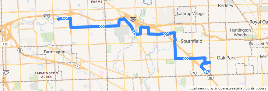
Route 400 WB: Providence Hospital => OCC
Places that travel to
Points of interest near the route
Stops:
- -83.24884150000001, 42.4796655
- -83.21646790000001, 42.45893
- American / 11 Mile NS (SB)
- 11 Mile / Beecham (WB)
- 11 Mile / Middlebelt (WB)
- -83.2241552, 42.458739300000005
- Franklin / Swanson (NB)
- J L Hudson / Greenfield NS (EB)
- -83.261717, 42.478906
- Franklin / Telegraph (NB)
- 11 Mile / Skye (WB)
- -83.2076074, 42.4591444
- J L Hudson / Providence NS (EB)
- American / Hantz Group (WB)
- 9 Mile / Northwestern (WB)
- Franklin / Imperial Senior Suites (NB)
- Northwestern / Northland (NB)
- Civic Center / Monticello Apts (WB)
- -83.2066016, 42.4564101
- 11 Mile / Westmeath (WB)
- Evergreen / Boardwalk (NB)
- -83.2402934, 42.4682788
- -83.3267766, 42.4854052
- -83.3399031, 42.4851644
- -83.3150335, 42.4856995
- -83.2996224, 42.4914562
- -83.3718406, 42.4916988
- -83.29561650000001, 42.4902348
- 11 Mile / Inkster NS (WB)
- -83.20653250000001, 42.448294100000005
- -83.28890720000001, 42.4844359
- Franklin / Regency Office Park (NB)
- -83.2862779, 42.480125900000004
- 11 Mile / Stanford (WB)
- Civic Center / 20700 (WB)
- Evergreen / Noel NS (NB)
- Oakland Community College Orchard Ridge (WB)
- American / Veoneer (SB)
- American / Hantz Bank (WB)
- -83.2406591, 42.4778479
- -83.20245560000001, 42.455048700000006
- -83.3589135, 42.4922472
- Northwestern / 26911 (WB)
- 11 Mile / Lynford (WB)
- -83.2703187, 42.4796263
- 9 Mile / Rutland (WB)
- Evergreen / Evergreen Place Apts (NB)
- -83.2880549, 42.4829895
- Northwestern / Courtyard (WB)
- -83.3579625, 42.4875582
- -83.31721230000001, 42.4855894
- -83.3064082, 42.485893000000004
- Beaumont / Civic Center (NB)
- 9 Mile / Providence (WB)
- 9 Mile / Gateway (WB)
- -83.3318672, 42.485318
- Evergreen / 9 Mile (NB)
- Franklin / Regal Towers (NB)
- -83.2931147, 42.488262600000006
- Providence / J L Hudson (NB)