Log masuk
Pengguna bintang
Undian
Laman utama
>
Australia
>
South Australia
>
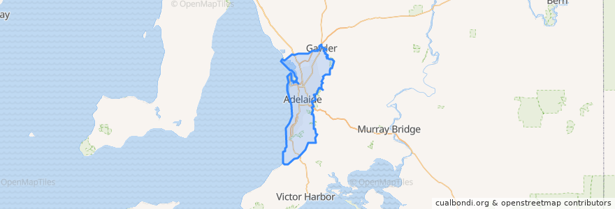
Adelaide
Adelaide
Lihat di peta interaktif
Laluan pengangkutan awam
170 - City to Urrbrae
170 - Urrbrae to City
171 - City to Mitcham Square
171 - Mitcham Square to City
172 - City to Kingswood
172 - Kingswood to City
222 - City (King William Street) to Mawson Lakes
222 - Mawson Lakes to City (King William Street)
222R - City to Mawson Lakes via Roma Mitchell Secondary College
224 - City to Elizabeth Interchange via Mawson Interchange
224 - Elizabeth Interchange to City via Mawson Interchange
224F - City to Elizabeth Interchange via Mawson Interchange Limited Setdown
224X - City to Elizabeth Interchange Express to Stop 29 then Mawson Interchange
253X - Mansfield Park to City
491 - Hewett Circuit
492A - Gawler East Circuit (Anticlockwise)
492C - Gawler East Circuit (Clockwise)
493 - Gawler South Circuit (Clockwise)
98A - City & North Adelaide Anti-Clockwise Loop
99A - City anti-clockwise loop via Town Hall, Rundle Mall, State Library & Museums, Royal Adelaide Hospital and Adelaide Central Market
99C - City clockwise loop via Town Hall, Rundle Mall, State Library & Museums, Royal Adelaide Hospital and Adelaide Central Market
Adelaide bus station => Albury railway station
Adelaide bus station → Bendigo railway station
Albury railway station => Adelaide bus station
Bendigo railway station → Adelaide bus station
Blackwood Station Interchange to Aldgate
Blackwood Station Interchange to City
Blackwood Station Interchange to Stirling
Bus 640 - Marino to Marion Centre Interchange
Bus 640 - Marino to Marion Centre Interchange
Bus 719 - City to Flinders University via South Road
Bus 719 - Flinders University to City via South Road
Bus 720 - City (King William Street) to Old Reynella via South Road, Marion Centre & Hallett Cove Centre
Bus 720H - City (King William Street) to Old Reynella via South Road, Flinders Medical Centre, Marion Centre & Hallett Cove Centre
Bus 720H - Old Reynella to City (King William St) via Hallett Cove Centre, Marion Centre, Flinders Medical Centre & South Road
Bus 720 - Old Reynella to City (King William St) via Hallett Cove Centre, Marion Centre & South Road
Bus 721 - Noarlunga Centre Interchange to City via Old Reynella
Bus 721 - Noarlunga Centre Interchange to City via Old Reynella
Bus 741A - Maslin Beach to Noarlunga Centre Interchange
Bus 741 - Maslin Beach to Colonnades Centre Interchange
Bus 741 - Noarlunga Centre Interchange to Maslin Beach
Bus 750A: Stop 137 Perth St - South side => Zone B Noarlunga Centre Interchange - West side
Bus 750B - Colonnades Centre Interchange to Aldinga
Bus 750C - Colonnades Centre Interchange to Seaford Centre
Bus 750 - Colonnades Centre Interchange to Sellicks Beach
Bus 750R - Sellicks Beach to Seaford Interchange
Bus 750 - Sellicks Beach to Colonnades Centre Interchange
Bus 750X - Seaford Interchange to Sellicks Beach (Express)
Bus 750X - Sellicks Beach to Seaford Interchange (Express)
Bus 751A - Aldinga Shopping Centre to Noarlunga Centre Interchange
Bus 751 - Aldinga Shopping Centre to Colonnades Centre Interchange
Bus 751C - Aldinga Shopping Centre to Seaford Centre
Bus 751 - Colonnades Centre Interchange to Aldinga Shopping Centre
Bus 751H - Aldinga Shopping Centre to Noarlunga Hospital
Bus 751R - Aldinga Shopping Centre to Seaford Interchange
Bus 751R - Colonnades Centre Interchange to Seaford Interchange
Bus 751W - Colonnades Centre Interchange to Willunga
Bus 751W - Seaford to Willunga
Bus 752 - McLaren Flat to McLaren Vale
Bus 752 - McLaren Vale to McLaren Flat
Bus 755 - Aldinga Beach - Seaford Centre
Bus 755 - Aldinga Beach to Seaford Centre
Bus 755 - Willunga to Aldinga Beach
Bus 756 - Norlunga Centre Interchange to Port Willunga
Bus 756 - Port Willunga to Seaford Centre Interchange
Bus 830F - City to Lobethal
Bus 830F - Lobethal to City
Bus 863: Aldgate to City
Bus 863: City to Aldgate
Bus 863F: Aldgate to City
Bus 863F: City to Aldgate
Bus T863: Aldgate to City
Bus T863: City to Aldgate
City (Currie Street) - Tea Tree Plaza via O-Bahn
City - Elizabeth Interchange via O-Bahn
City - Fairview Park via O-Bahn
City - Golden Grove Interchange & Tea Tree Plaza Interchange via O-Bahn
City - Golden Grove Interchange via O-Bahn
City - Greenwith & Tea Tree Plaza Interchange via O-Bahn
City - Greenwith & Tea Tree Plaza Interchange via O-Bahn
City - Greenwith & Tea Tree Plaza Interchange via O-Bahn
City (Grenfell Street) - Elizabeth Interchange via O-Bahn
City (Grenfell Street) - Mawson Interchange via O-Bahn
City (Grenfell Street) - Para Hills via O-Bahn
City (Grenfell Street) - Salisbury Interchange via O-Bahn
City (Grenfell Street) - Salisbury Interchange via O-Bahn
City (Grenfell Street) - Tea Tree Plaza via O-Bahn
City (Grenfell Street) - Tea Tree Plaza via O-Bahn
City (Grenfell Street) - Tea Tree Plaza via O-Bahn
City (King William Street) - Glenelg via Unley Road & Raglan Avenue
City (King William Street) - Hove (Dunrobin Road) via Ferry Avenue & Morphett Road
City (King William Street) - Marion Centre via Ferry Avenue & Diagonal Road
City (King William Street) - Northgate
City to Marion Centre Interchange
Elizabeth Interchange - City via O-Bahn
Flinders University - City (King William Street) - Golden Grove Village via O-Bahn
Gawler Central Line (inbound)
Gawler Central Line (outbound)
Glenelg - City (King William Street) via Unley Road & Raglan Avenue
Golden Grove Interchange & Tea Tree Plaza Interchange - City via O-Bahn
Golden Grove Village - City (King William Street) - Flinders University via O-Bahn
Hove (Dunrobin Road) - City (King William Street) via Ferry Avenue & Morphett Road
Marion Centre - City (King William Street) - Golden Grove Village via O-Bahn
Marion Centre - City (King William Street) via Ferry Avenue & Diagonal Road
Marion Centre Interchange to City
Northgate - City (King William Street)
Route 543 - Surrey Downs to Tea Tree Plaza Interchange
Suburban Connector (anti-clockwise)
Suburban Connector (clockwise)
The Ghan
Train BEL: Adelaide Railway Station => Belair Railway Station
Train BEL: Belair Railway Station => Adelaide Railway Station
Train FLNDRS: Adelaide Railway Station => Flinders Railway Station
Train FLNDRS: Flinders Railway Station => Adelaide Railway Station
Train GAW: Adelaide Railway Station => Gawler Railway Station
Train GAW: Gawler Railway Station => Adelaide Railway Station
Train GLAN: Adelaide Railway Station => Glanville Railway Station
Train GLAN: Glanville Railway Station => Adelaide Railway Station
Train GRNG: Adelaide Railway Station => Grange Railway Station
Train GRNG: Grange Railway Station => Adelaide Railway Station
Train Indian Pacific
Train Indian Pacific
Train NOAR: Noarlunga Railway Station => Adelaide Railway Station
Train OSBORN: Adelaide Railway Station => Osborne Railway Station
Train OSBORN: Osborne Railway Station => Adelaide Railway Station
Train OUTHA: Adelaide Railway Station => Outer Harbor Railway Station
Train OUTHA: Outer Harbor Railway Station => Adelaide Railway Station
Train SALIS: Adelaide Railway Station => Salisbury Railway Station
Train SALIS: Salisbury Railway Station => Adelaide Railway Station
Train SEAFRD: Adelaide Railway Station => Seaford Railway Station
Train SEAFRD: Seaford Railway Station => Adelaide Railway Station
Tram BTANIC: Botanic Gardens Tram Stop => Entertainment Centre Tram Stop
Tram BTANIC: Entertainment Centre Tram Stop => Botanic Gardens Tram Stop
Tram FESTVL: Festival Plaza Tram Stop => Stop 17 Moseley Square
Tram FESTVL: Stop 17 Moseley Square => Festival Plaza Tram Stop
Tram GLNELG: Entertainment Centre Tram Stop => Stop 17 Moseley Square
Tram GLNELG: Royal Adelaide Hospital Tram Stop => Stop 17 Moseley Square
Tram GLNELG: Stop 17 Moseley Square => Entertainment Centre Tram Stop
Tram GLNELG: Stop 17 Moseley Square => Royal Adelaide Hospital Tram Stop
Urrbrae to Aldgate
West Lakes Centre - Adelaide Airport - Marion Centre
Perhentian
Stop 157 Sunnyside Drive - East side
Stop 84 Griffiths Drive - South East side
Stop 23 Princes Road - South side
Stop 122A Aldinga Beach Road - South side
Stop 180 Overway Bridge Road - North West side
City South
Stop 21 Main North Road - West side
Stop 166 Clark Road - South side
Stop 12 Glen Osmond Road - South West side
138.62282430000002, -34.7830892
105 - Main North Road
Stop 22 Main North Road - West side
Stop 125 Lyndoch Road - South side
Stop I1 Halifax St - North side
Stop 2 King William Road - West side
Stop 24 Main North Road - West side
106 - Paxton Street
City South
138.59980040000002, -34.9251285
138.60334500000002, -34.8436845
Pirie Street
Stop E3 Currie Street - North side
Stop 12 Glen Osmond Road - North East side
138.6147929, -34.827741800000005
Stop 177 Brigalo Street - South side
Stop 150 Hill Street - East side
Stop 154 Krieg Road - North East side
138.59966210000002, -34.9261214
138.6114228, -34.8193678
138.664154, -34.729666200000004
Tempat menarik
Hut and Soul Eatery
Beyond India
Salisbury Interchange
48 Flavours
Johnny Come Lately
Happy Bite Snack Bar
Loc= Bottle Bar
Kafana Kitchen and Bar
School Canteen
hungry hippo boardgame cafe
Snowwwww Skewers Bar
Reynella Community Children's Centre
Hello Harry
The Corporation of the Town of Walkerville
Ancient Viet
Sazon Kitchen Bar
Hey Darling
Real Rolls
The Monastery
Penang Hawkers Corner
Cry Baby
Tony Tomatoes
OTR Aldinga
Budget
Carpe Diem Desert Bar
Foodland
Bakim Lim Noodle Project
Hungry Jack's
Sikh Society of South Australia Gurdwara Temple
Tasty xi'an