وارد شدن
کاربران ستاره
نظرسنجی
شروع
>
The Hills Shire Council
>
Rouse Hill
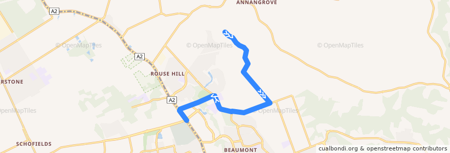
مسیر
Rouse Hill
اولین نظر را بنویسید
در نقشه تعاملی مشاهده کنید
نقاط مورد علاقه در نزدیکی مسیر
Dimples Childcare Centre
Café Lélunar
Australia Post
Sushi Musa
MEAT AND FIRE BBQ
Choice Pharmacy
Our Lady of the Angels
Moss Bros Dessert & Brunch Cafe
McDonald's
Gustoso
Mad Mex Fresh Mexican Grill
Barlame
Nando's
St.George
Kaito
Vinegar Hill Memorial Library
Thai Splendid
Roll'd
The Bavarian
The Chook
ANZ
Rouse Hill Medical & Dental
The Fiddler
Caffe Cherry Beans
Lezette
The Coffee Club
KFC
NAB
Reading Cinema
Leaf Cafe & Co
Commonwealth Bank
P'Nut Street Noodles
Grill'd
Outdoor theatre space
North Kellyville Medical Centre
Eat GRK
Westpac
Boost Juice
Baskin-Robbins
ایستگاه:
150.94242260000001, -33.6706844
Withers Rd after Horan Rd
150.9402231, -33.6694477
Rouse Hill High School, Withers Rd
150.94829660000002, -33.6834274
150.92645140000002, -33.6856041
Barry Rd at Serpentine Ave
150.9357036, -33.665978700000004
Rouse Hill Drive
Stringer Rd after Timbarra Ave
Stringer Rd before Barry Rd
Withers Rd before Mungerie Rd
Withers Rd at Glenburnie Cl walkway