Login
Star users
Poll
Home
>
Switzerland
>
St. Gallen
>
Wahlkreis Toggenburg
>
Ebnat-Kappel
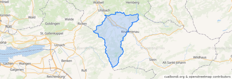
Ebnat-Kappel
See in interactive map
Routes of public transport
Bus 770: Ebnat, Wier => Lichtensteig, Steigrüti
Bus 770: Ebnat, Wier → Wattwil
Bus 770: Lichtensteig, Steigrüti => Ebnat, Wier
Bus 770: Nesslau-Neu St.Johann → Wattwil → Lichtensteig
Bus 770: Wattwil → Ebnat, Wier
Bus 770: Wattwil → Nesslau-Neu St.Johann
Bus 790: Buchs SG → Wattwil
Bus 790: Wattwil → Buchs SG
S2: Altstätten SG => Nesslau-Neu St. Johann
S2: Altstätten SG => Nesslau-Neu St. Johann
S2: Nesslau-Neu St. Johann => Altstätten SG
S2: Nesslau-Neu St. Johann => Altstätten SG
Stops
Krummenau
Au
Wier
Gieselbach
Wier
Ebnat-Kappel Bahnhof
Kapplerhof
Gieselbach
Acker
Ebnat-Kappel Bahnhof
Gieselbach
Ebnat-Kappel Bahnhof
Ebnat-Kappel Gemeindehaus
Kapplerhof
Kappel Mitteldorf
Kappel Mitteldorf
Ebnat-Kappel Bahnhof
Mühlau
Ebnat-Kappel Gemeindehaus
Acker
Mühlau
Kapplerhof
Kappel Mitteldorf
Au
Ebnat-Kappel
Au
Kappel Mitteldorf
Gieselbach
Kapplerhof
Au
Points of interest
Palais Extra
Sansibar
Clientis Bank Thur
Gill-Apotheke
Kirche Jesu Christi der Heiligen der Letzten Tage
Alterssiedlung GIll
Ebnat-Kappel Bahnhof
Dr.Hettich
Oberstufenzentrum Wier
Dr. Rohner
Dr. Singer
Tageszentrum Toggenburg
Raiffeisenbank Mittleres Toggenburg
FCGT
Café Abderhalden
Kunz
Ebnat-Kappel
Clientis Bank Thur
Avia
Bikebox
ToiToi
Blume
Traube
Jugendtreff Ebnat-Kappel
Die Fabrik
Poststelle
Speerblick
Dr.Lanz
Feuerwehr Ebnat-Kappel
Ristorante Pizzeria La Stazione