Accesso
Utenti preferiti
Sondaggio
Homepage
>
Stati Uniti d'America
>
Maryland
>
Prince George's County
>
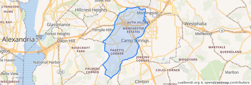
Camp Springs
Camp Springs
Visualizza nella mappa interattiva
Percorsi di trasporto pubblico
Commuter Bus 705: Charlotte Hall/Waldorf
Commuter Bus 705: Washington, D.C.
Commuter Bus 715: Charlotte Hall/Waldorf (trips 13;26)
Commuter Bus 715: Charlotte Hall/Waldorf (trips 14-25)
Commuter Bus 715: Washington, D.C.
Commuter Bus 725: California/Charlotte Hall
Commuter Bus 725: Washington, D.C.
Commuter Bus 735: Charlotte Hall/Waldorf
Commuter Bus 735: Washington, D.C.
Commuter Bus 850: Prince Frederick/Dunkirk
Commuter Bus 850: Suitland/Washington, D.C.
TheBus Route 33 Camp Springs/Owen Road
WMATA C11 Clinton Line
WMATA Green Line: Branch Avenue → Greenbelt
WMATA Green Line: Greenbelt → Branch Avenue
Fermate
Branch Avenue
Branch Avenue
G
Punti di interesse
Mount Hope Cemetery
St Philip The Apostle Catholic School
Church of the Nativity
Evangelical Assembly of God
Progressive Christian Academy
Crossland High School
Allenwood Elementary School
Bethany Christian Church
Camp Springs
St. Philip the Apostle
Evangelical Assembly of God
Cross Cultures Learning Center
Progressive Church
Crossland Evening High School
Henson Valley Montessori School
Camp Springs United Methodist Church
Mount Hope Church
Oxon Hill Church of Christ