Login
Star users
Poll
Home
>
United States
>
Arizona
>
Yavapai County
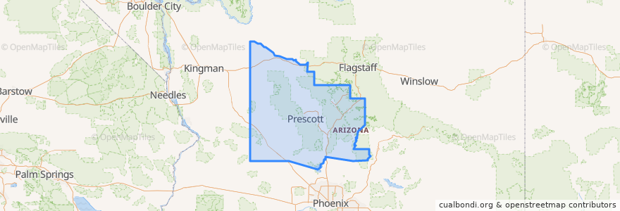
Yavapai County
See in interactive map
Routes of public transport
Bus VL: Cottonwood => Sedona
Places
Cottonwood
(1)
Big Park
(0)
Camp Verde
(0)
Chino Valley
(0)
Clarkdale
(0)
Congress
(0)
Dewey-Humboldt
(0)
Jerome
(0)
Paulden
(0)
Prescott
(0)
Prescott Valley
(0)
Yarnell
(0)
Stops
Mingus & Main (Circle K)
Northview & Mountain Shadows
Sunset & Coffee Pot (Wallgreens)
Mingus at 8th (By Walking Bridge)
Upper Red Rock Loop Rd. (High School)
Shelby & Rodeo (WelIs Fargo Bank)
-111.8226128, 34.8554918
Stutz Bearcat & Andante (Andante Inn)
Arroyo Pinon & Dry Creek (Kokopellis)
Soldiers Pass Rd. (Biddles)
Cottonwood Library
Points of interest
Coffee Pot Restaurant
Sedona City Hall
Big Park
Jerome
Paulden
Red's at Sedona Rouge
Starbucks
Clemenceau Public School
Clarkdale
Local Juicery
Sedona
Herkenham
Prescott
Dewey-Humboldt
Yarnell
Starbucks
West Side Deli
Domino's Pizza
Dairy Queen
Sedona Magistrate Court
Prescott Valley
Yavapai County
Chino Valley
Congress
Main Stage
Jerona
Hiro's Japanese Sushi Bar
Annie's
Cottonwood-Oak Creek School
Barlow Jeep Rentals