Login
Star users
Poll
Home
>
United States
>
Oregon
>
Washington County
>
Hillsboro
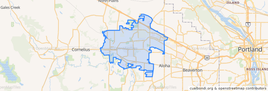
Hillsboro
See in interactive map
Routes of public transport
Bus 46: Hillsboro Brookwood Library=> Hillsboro Transit Center
Bus 46: Hillsboro Transit Center => Hillsboro Brookwood Library
Bus 47: Hillsboro Transit Center => Portland Community College Rock Creek
Bus 47: Portland Community College Rock Creek => Hillsboro Transit Center
Bus 48: Hillsboro Transit Center => Sunset Transit Center
Bus 48: Sunset Transit Center => Hillsboro Transit Center
Bus 52: Beaverton Transit Center => Portland Community College Rock Creek
Bus 52: Portland Community College Rock Creek => Beaverton Transit Center
Bus 57: Beaverton Transit Center => Forest Grove
Bus 57: Forest Grove => Beaverton Transit Center
Bus 59: Sunset Transit Center => Willow Creek Transit Center
Bus 59: Willow Creek Transit Center => Sunset Transit Center
Bus 5: Portland => Tillamook
Bus 5: Tillamook => Portland
Bus 88: Beaverton Transit Center => Willow Creek Transit Center
Bus 88: Willow Creek Transit Center => Beaverton Transit Center
MAX Blue Line: Gresham => Hillsboro
MAX Blue Line: Hillsboro => Gresham
North Hillsboro Link: Orenco Station => Westmark Center
North Hillsboro Link: Westmark Center => Orenco Station
Stops
Northeast Century & Deer Run
Northwest 185th & Sunset Square
Southeast Baseline Street & 2nd
2800 Block Northwest Glencoe
East Main & Northeast 40th
East Main & Northeast 49th
Orenco
Southwest 185th & Salix Terrace
Northeast Cornell & Hillaire Drive
Northwest Glencoe & Cody Court
West Baseline & Southwest 185th
Southeast Tualatin Valley Highway & Imlay
Bennett Street
Northeast Cornell & Grant
West Baseline Road & Southwest 185th
East Main & Southeast 33rd
Northeast Cornell & 106th (NW 188th)
East Main & Northeast Brookwood
Southeast Tualatin Valley Highway & Brookwood
Southeast Tualatin Valley Highway & 30th
Southeast Tualatin Valley Highway & 11th Southbound
Northeast Cornell & Northwest Walbridge
East Main & Southeast 18th
Northeast Brookwood Pkwy & 49th Place
East Main & Northeast 14th
Hatfield Government Center
2500 Block Northeast Century
300 Block East Main
Northeast Orenco Station Loop & MAX Station
Tuality Hospital/Southeast 8th Avenue
Points of interest
Water Play Pump
Aloha Bible Church
Washington Street Conference Center
New Dragon Fountain Restaurant
Big Town Hero
Juice It Up
CVS Pharmacy
USPS
Wasabi
Ma-Now
ABV Public House
Swagath
Wells Fargo
Virginia Garcia Dental Clinic
Subway
Lil Cooperstown Pub
Starbucks
Yuki Sushi and Sake bar
Hawaiian Kine BBQ
Meals on Wheels People
Chinese Evangelical Church
Little Caesars
MOD Pizza
Blink
Country Haven Mobile Home Park
ChargePoint
Schmizza Public House
Splash Play Area
Deep Space Brewing
Malone's Ale House