Accesso
Utenti preferiti
Sondaggio
Homepage
>
Stati Uniti d'America
>
Utah
>
Davis County
>
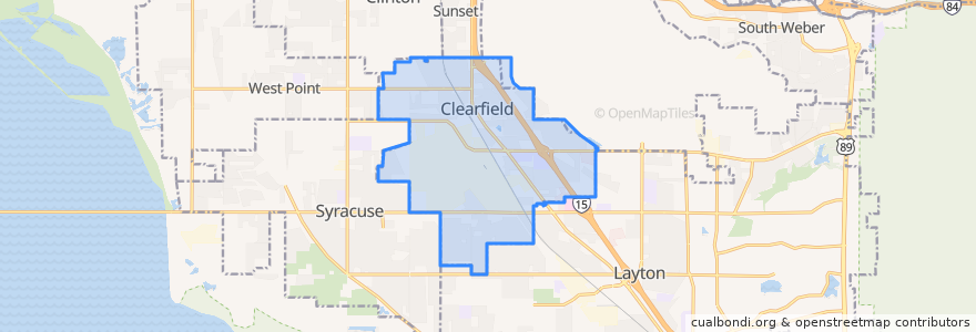
Clearfield
Clearfield
Visualizza nella mappa interattiva
Percorsi di trasporto pubblico
UTA Route 472 Riverdale to Salt Lake Express (to Riverdale Park and Ride)
UTA Route 472 Riverdale to Salt Lake Express (to Salt Lake)
UTA Route 626 West Roy/Clearfield Station (to West Roy)
UTA Route 627 Clearfield Station/Kaysville/DTC (to Clearfield Station)
Punti di interesse
Antelope Elementary School
James Ammon, RPh
AAFES
Subway
Clearfield
Maverik
North View Pharmacy
Redbox
Manuel's El Burrito
Saint Peters Episcopal Church
The Pizza Factory
The Church of Jesus Christ of Latter-day Saints
The Church of Jesus Christ of Latter-day Saints
Davis County Library North Branch
Coombs Orthodontics
The Church of Jesus Christ of Latter-day Saints
School of Saint Peter
Hill Field School
The Church of Jesus Christ of Latter-day Saints
New Hope Fellowship
Davis Drug
Chevron
Argentine Corner
Lucky Slice
Calvary Chapel
Little Caesars
Clearfield Community Church
Louie's Pizza
Davis Hospital Pharmacy
Wasatch Peak Family Practice & Oceans Contours