Login
Star users
Poll
Home
>
United States
>
California
>
Contra Costa County
>
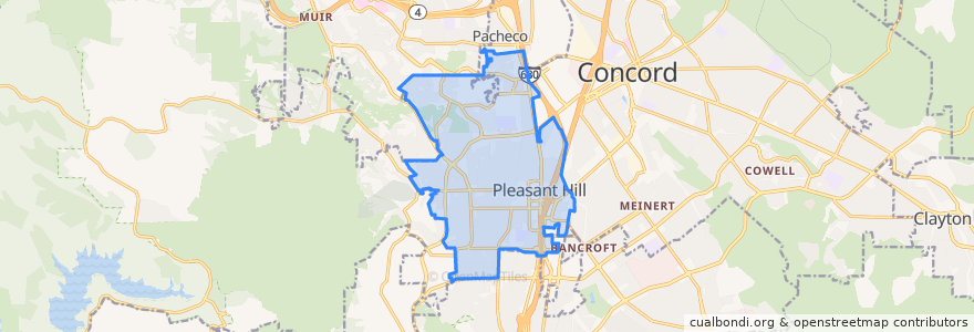
Pleasant Hill
Pleasant Hill
See in interactive map
Routes of public transport
County Connection 16: Martinez Amtrak => Downtown Pleasant Hill => Concord BART
SolanoExpress Yellow Line: Vallejo => Pleasant Hill => Walnut Creek
SolanoExpress Yellow Line: Vallejo => Sunvalley Mall => Walnut Creek
SolanoExpress Yellow Line: Vallejo => Vallejo Ferry Terminal => Sunvalley Mall => Walnut Creek
SolanoExpress Yellow Line: Vallejo => Vallejo Ferry Terminal => Walnut Creek
SolanoExpress Yellow Line: Vallejo => Walnut Creek
SolanoExpress Yellow Line: Walnut Creek => Sunvalley Mall => Vallejo
SolanoExpress Yellow Line: Walnut Creek => Vallejo
SolanoExpress Yellow Line: Walnut Creek => Vallejo Ferry Terminal => Vallejo
Stops
Contra Costa Boulevard & Viking Drive
Contra Costa Boulevard & Viking Drive
Contra Costa Boulevard & Golf Club Road
Contra Costa Boulevard & Viking Drive
Contra Costa Boulevard & Golf Club Road
Contra Costa Boulevard & Golf Club Road
Contra Costa Boulevard & Viking Drive
Contra Costa Boulevard & Golf Club Road
Points of interest
Magoo's Grill
Gotta Eata Pita
Starbucks
Sweet Tomatoes
Fresenius Medical Care
Rite Aid
Pollo Pollo
Lucille's Smokehouse Bar-B-Que
Mist Hookah Lounge
Starbucks
Citibank
Thai Osha
Peet's Coffee
Starbucks
Rubio's
Wingstop
CVS Pharmacy
Togo's Sandwiches
Chipotle
Physical Rehabilitation Center, Pleasant Hill
Boston Market
Jack's Restaurant & Bar
The Original Pancake House
Rubio's
Yokoso Sushi Restaurant
Action Urgent Care
Starbucks
Fat Maddie's
Little Free Library
Cold Stone Creamery