Accesso
Utenti preferiti
Sondaggio
Homepage
>
Manhattan
>
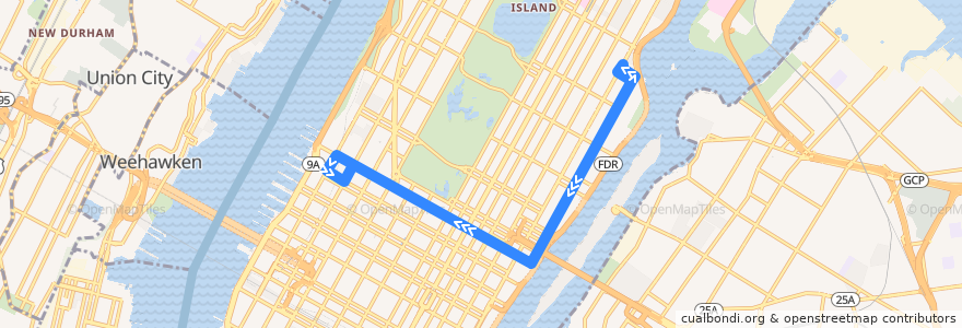
NYCB - M31
Itinerario
NYCB - M31
scrivi la prima recensione
Luoghi nel percorso
New York County
Manhattan Community Board 6
Manhattan
Manhattan Community Board 8
Manhattan Community Board 4
Manhattan Community Board 5
Visualizza nella mappa interattiva
Punti di interesse vicino al percorso
New Ichiro
Wing Bistro
Public School 290
Icon Parking
Public School 190
Subway
Krua
East Japanese Restaurant
Characters NYC Bar & Lounge
Ginza
Dos Toros Taqueria
Akami Sushi
Newton-Timmermann Pharmacy
Yogurtland
Citi Bike E 91 Street & 2 Avenue
Tenzan 89
USA Vein Clinic
Le Reve
East Side Animal Hospital
The UPS Store
Ninth Street Espresso
Bank of America
Dunkin' Donuts
Public School 183
Neary’s
Gina Mexicana
International Wings Factory
Dunkin' Donuts
Timmy's
Pollock & Bailey Pharmacy
Matts Grill
Wayfarer
Café Metro
99c pizza
Betony
Pick a Bagel
Russian Vodka Room
Zibetto Espresso Bar
Cafe Jax
Andaman Thai Bistro
Joe & The Juice
Spiritist Group of New York
Citibank
Justino's Pizza
La Silhouette
Lindys
Chipotle
Benoit
Pho Shop
Starbucks
Luigi's Pizza
Yefsi Estiatorio
Guantanamera
Chase
United States Post Office
Holey Cream
Georgio's Country Grill
Xi'an Famous Foods
Dunkin'
Cafe 53
Fermate:
West 57th Street/7th Avenue
West 57th Street & 7th Avenue
West 57th Street & 7th Avenue
York Avenue/East 60th Street
West 57th Street/7th Avenue
-73.95893500000001, 40.759541500000005