تسجيل الدخول
مستخدمي ستار
تصويت
الصفحة الرئيسية
>
Grand Junction
>
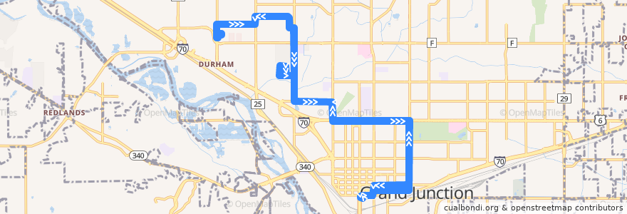
Route 7 - College Connector
مسلك
Route 7 - College Connector
اكتب أول مراجعة
الأماكن التي تسافر إليها
Grand Junction
انظر في الخريطة التفاعلية
النقاط المهمة بالقرب من الطريق
Bank of the West
Zoup
Pollo Azado
Valley View Hospital Heart & Vascular Center, Grand Junction Clinic
U.S. Bank
Java Junction
Old Man Grill
Mountain Grind Coffee
Einstein Bros. Bagels
Northpointe Bank
Colorado Christian University
Yogo Mojo
Caroylyn Lampshire Skin Care & Reflexology
750 Main Coworking
Parkway Dental
Mesa Experimental Theatre (MET)
Charleys Philly Steaks
Taco Party
Mail Suite
Hawthorne School
Hot Dog Stand
Which Wich?
Cafe Court
Pink's BBQ
Core Health Strategies
No Coast Sushi
Papa Murphy's
Suite 410 Love Shack
Starbucks
Leshae Jones C.M.T
The Cashmere Slippers Gourmet & Comfortable Food
Jimmy John's
The Point
Little Dipper, Bubbles & Puffenstuff
Costa Vida Fresh Mexican Grill
Every drop matters
Campus Police
Avis
La Calle 5
Chick-fil-A
Baron's
Feisty Pint
Commuter Parking
Volleys
Subway
water fountain
Bravo Pizza
Fine Arts Building
Western Union
Whitman School
Appleton Clinics
Taqueria Guadelajara
Grand Junction Police Department
Robinson Theatre
Einstein Bros. Bagels
Starbucks
موقف:
Independent Avenue + Across from Poplar Drive
North Avenue + West of 11th Street
562 West Crete Circle (Food Bank)
North Avenue + East of 3rd Street
Independent Avenue + East of Poplar Drive
-108.56084630000001, 39.080677300000005
12th Street + North of Pitkin Avenue
12th Street + South of Colorado Avenue (Partners)
25 1/2 Road + South of Dewey Place
North Avenue + West of 3rd Street
F 1/4 Road @ Goodwill
1st Street + North of Kennedy Avenue
25 1/2 Road + North of Pinyon (Moose Lodge)
25 1/2 Road + South of Patterson Road (Paradise Valley)
25 1/2 Road + North of Pinyon
12th Street + North of Ouray Avenue
5th Street + North of Grand Avenue (Library)
North Avenue + West of 7th Street
F 1/4 Road + West of 25 Road
12th Street + North of Grand Avenue
25 1/2 Road + North of Patterson Road
Blichman Avenue + East of 25 Road (WCCC Outbound)
12th Street + South of North Avenue (Lincoln Park Barn)
25 1/2 Road + South of Patterson Road (Pomona Elementary)
Blichman Avenue + East of Hollingsworth Street
F 1/4 Road + West of 25 Road
12th Street + North of Main Street
Independent Avenue + West of 1st Street
25 1/2 Road + North of Independent Avenue (Sam's Club)
North Avenue + West of 5th Street
North Avenue + East of Cannell Street (Pullout)
1st Street + North of Sherwood Drive
Blichman Avenue + East of 25 Road (WCCC Inbound)
25 1/2 Road + North of Independent Avenue
12th Street + South of Teller Avenue (Church)
Blichman Avenue + East of Hollingsworth Street (XCEL Energy)
F 1/4 Road + East of Balanced Rock Street
North Avenue + East of 8th Street
North Avenue + West of 7th Street (REI Sports)
North Avenue + East of 5th Street
12th Street + South of Grand Avenue
1st Street + South of Franklin Avenue