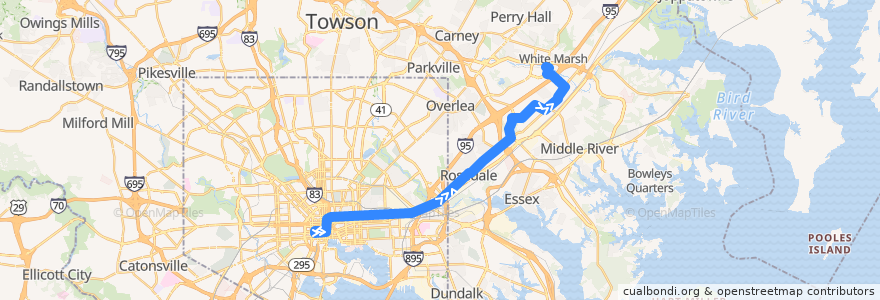
Route LocalLink 56: White Marsh Park & Ride
Places that travel to
Points of interest near the route
Stops:
- -76.5433443, 39.303176
- Philadelphia Road & Middle River Road Northbound
- Campbell Boulevard & Philadelphia Road Westbound
- Philadelphia Road & Ravenwood Road Opposite Northbound
- Philadelphia Road & Rosedale Heights Avenue Eastbound
- -76.5496847, 39.301199000000004
- Fayette Street Plaza Westbound
- King Avenue & King Arthur Circle Eastbound
- -76.47153540000001, 39.355429300000004
- Franklin Square Hospital Opposite Eastbound
- 9103 Franklin Square Drive Eastbound
- Philadelphia Road & Fontana Lane Opposite Eastbound
- -76.5548413, 39.2998716
- -76.6184333, 39.289388100000004
- Franklin Square Drive & Canterbury Apartments Entrance Eastbound
- -76.4778088, 39.3506887
- -76.5694747, 39.299348
- Baltimore Arena Bay 2
- Campbell Boulevard & Franklin Square Drive Westbound
- 9729 Philadelphia Road Northbound
- -76.54722240000001, 39.301966900000004
- King Avenue & Philadelphia Road Eastbound
- Franklin Square Hospital Westbound
- -76.56764480000001, 39.299421300000006
- Philadelphia Road & Petrie Way Eastbound Far-side
- -76.6187147, 39.2893771
- White Marsh Park & Ride
- Pulaski Highway & 62nd Street Opposite Eastbound
- Philadelphia Road & Rosedale Avenue Eastbound
- Philadelphia Road & Longview Avenue Eastbound
- Philadelphia Road & Rosedale Avenue Eastbound
- Franklin Square Drive & Canterbury Apartments Entrance Eastbound
- 9200 Franklin Square Drive Eastbound
- -76.54725350000001, 39.3020275
- Baltimore Street & Howard Street Mid-block Eastbound
- Campbell Boulevard & Town Center Drive Northbound
- Philadelphia Road & A&J Way Northbound
- White Marsh Park & Ride
- Pulaski Highway & 62nd Street Opposite Eastbound
- 9200 Franklin Square Drive Eastbound
- -76.53970580000001, 39.304268900000004
- -76.54331710000001, 39.303106400000004
- Philadelphia Road & A&J Way Northbound
- Philadelphia Road & Middle River Road Northbound
- -76.5497077, 39.301244000000004
- -76.5676394, 39.2993818
- -76.6163799, 39.290466
- Philadelphia Road & Rosewick Avenue Opposite
- -76.55484530000001, 39.2999154
- King Avenue & Armada Way Eastbound
- King Avenue & King Arthur Circle Eastbound
- -76.5576683, 39.299744000000004
- Philadelphia Road & Petrie Way Eastbound Far-side
- Philadelphia Road & Rosedale Heights Avenue Eastbound
- -76.48365340000001, 39.3504659
- Philadelphia Road & 66th Street Far-side Eastbound
- Philadelphia Road & Fontana Lane Opposite Eastbound
- -76.56347790000001, 39.299578700000005
- -76.56947070000001, 39.299300300000006
- Campbell Boulevard & Philadelphia Road Westbound