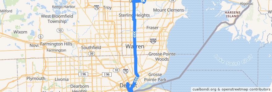
Route 510 SB: Lakeside => VA Hospital via Meijer
Orte, an denen diese Route vorbeiführt
Sehenswürdigkeiten in der Nähe der Route
Haltestellen:
- -83.0290875, 42.357013300000006
- -83.02872710000001, 42.543378000000004
- Van Dyke / Sterling Place (SB)
- -83.0153228, 42.3796909
- -83.0336738, 42.350123100000005
- Van Dyke / Civic Center S (SB)
- -83.0352488, 42.3481906
- -83.046441, 42.3295407
- Cass / Adams NS (NB)
- -83.02775720000001, 42.4909327
- -83.02474930000001, 42.447575900000004
- Gratiot / Van Dyke (SB)
- -83.00082900000001, 42.6272281
- Lakeside Mall
- Van Dyke / Crestview (SB)
- Van Dyke / Dobel (SB)
- -83.02666760000001, 42.462671
- Van Dyke / 17 Mile (SB)
- Van Dyke / Hall (SB)
- -83.03766040000001, 42.3450792
- -83.0307598, 42.587458600000005
- Gratiot / Chene (SB)
- Van Dyke / 12 Mile (SB)
- Van Dyke / Stockton (SB)
- -83.02314840000001, 42.404731500000004
- Gratiot / Joseph Campau (SB)
- Van Dyke / Old 13 Mile (SB)
- -83.0226525, 42.3925581
- -83.0235882, 42.4162455
- -83.0288759, 42.5198693
- Cass / Times Square (NB)
- Van Dyke / Wood (SB)
- Van Dyke / Forestlawn NS (SB)
- Hall / Schoenherr (WB)
- -83.0285719, 42.511590000000005
- -83.02913480000001, 42.539369900000004
- Randolph / Farmer (SB)
- -83.02933270000001, 42.5361805
- Hall / Northpointe (WB)
- Van Dyke / Bliss (SB)
- -83.0291705, 42.550831900000006
- Van Dyke / Hudson (SB)
- Van Dyke / 11 Mile (SB)
- Van Dyke / Savage (SB)
- Hall / Klingkammer (WB)
- -83.0204777, 42.3700836
- -83.0243018, 42.435398500000005
- -83.02341460000001, 42.4117498
- -83.0521353, 42.3316691
- Gratiot / St Antoine (SB)
- -83.0280367, 42.4987128
- -83.02965900000001, 42.5610427
- John R / Canfield NS (NB)
- Sterling Heights Meijer
- -83.0301458, 42.572333900000004
- Van Dyke / 14 Mile (SB)
- Van Dyke / Constitution (SB)
- -83.0229887, 42.400726600000006
- -83.02395940000001, 42.426058100000006
- Gratiot / Townsend (SB)