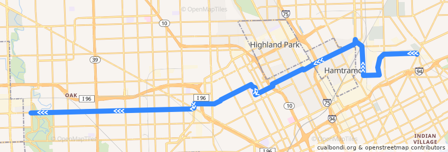
Route 38 WB: Gratiot => Outer Dr
Places that travel to
Points of interest near the route
Stops:
- -83.0256209, 42.399134800000006
- Grinnell / Erwin (WB)
- Byron / Collingwood (SB)
- -83.23659020000001, 42.3718878
- Elmhurst / Cloverdale (WB)
- -83.1044428, 42.3827075
- -83.09851110000001, 42.385668200000005
- Plymouth / Lauder (WB)
- -83.037521, 42.396016
- -83.06021530000001, 42.3996688
- St Cyril / Marcus (SB)
- -83.21401510000001, 42.3722985
- -83.018073, 42.4009054
- Plymouth / Fielding (WB)
- -83.127913, 42.3798836
- -83.0495958, 42.403580500000004
- -83.0931539, 42.3879207
- Caniff / St Aubin NS (WB)
- -83.11649530000001, 42.384373700000005
- Collingwood / 2nd NS (WB)
- Caniff / Oakland NS (WB)
- -83.0665549, 42.3973358
- Plymouth / Greenfield (WB)
- -83.026852, 42.3958193
- -83.2197405, 42.372196200000005
- -83.07839030000001, 42.3934585
- -83.01258030000001, 42.401088200000004
- Miller / Sherwood (WB)
- Calvert / Rosa Parks (WB)
- Grinnell / Grace (WB)
- Plymouth / Auburn (WB)
- -83.18828210000001, 42.372817000000005
- Mt Elliott / Evaline (NB)
- -83.07706610000001, 42.393216100000004
- Plymouth / Schaefer (WB)
- -83.1502134, 42.3759439
- Elmhurst / Lawton (WB)
- -83.1013356, 42.3838391
- Plymouth / Steel (WB)
- -83.22210700000001, 42.372146900000004
- Miller / Helen (WB)
- La Salle / Lawrence (NB)
- Elmhurst / Yellowstone (WB)
- Plymouth / Faust (WB)
- -83.00093070000001, 42.400848100000005
- -83.1556838, 42.3735627
- Elmhurst / Holmur (WB)
- -83.0895323, 42.389263
- Plymouth / Sussex (WB)
- -83.19027630000001, 42.372767700000004
- Elmhurst / Santa Rosa (WB)
- -83.0374539, 42.3944099
- -83.1709709, 42.3731686
- Mt Elliott / Dorothy (NB)
- Plymouth / Evergreen (WB)
- -83.16855340000001, 42.3732218
- Caniff / Russell (WB)
- -83.1784209, 42.373033500000005
- Plymouth / Northlawn NS (WB)
- -83.0870601, 42.390183300000004