Login
Star users
Poll
Home
>
Australia
>
South Australia
>
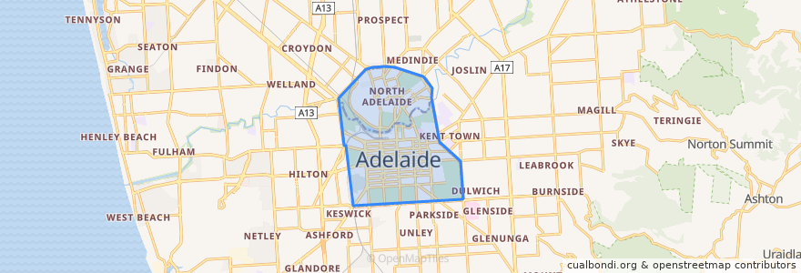
Adelaide City Council
Adelaide City Council
See in interactive map
Routes of public transport
170 - City to Urrbrae
170 - Urrbrae to City
171 - City to Mitcham Square
171 - Mitcham Square to City
172 - City to Kingswood
172 - Kingswood to City
222 - City (King William Street) to Mawson Lakes
222 - Mawson Lakes to City (King William Street)
222R - City to Mawson Lakes via Roma Mitchell Secondary College
224 - City to Elizabeth Interchange via Mawson Interchange
224 - Elizabeth Interchange to City via Mawson Interchange
224F - City to Elizabeth Interchange via Mawson Interchange Limited Setdown
224X - City to Elizabeth Interchange Express to Stop 29 then Mawson Interchange
253X - Mansfield Park to City
98A - City & North Adelaide Anti-Clockwise Loop
99A - City anti-clockwise loop via Town Hall, Rundle Mall, State Library & Museums, Royal Adelaide Hospital and Adelaide Central Market
99C - City clockwise loop via Town Hall, Rundle Mall, State Library & Museums, Royal Adelaide Hospital and Adelaide Central Market
Adelaide bus station => Albury railway station
Adelaide bus station → Bendigo railway station
Albury railway station => Adelaide bus station
Bendigo railway station → Adelaide bus station
Blackwood Station Interchange to City
Bus 719 - City to Flinders University via South Road
Bus 719 - Flinders University to City via South Road
Bus 720 - City (King William Street) to Old Reynella via South Road, Marion Centre & Hallett Cove Centre
Bus 720H - City (King William Street) to Old Reynella via South Road, Flinders Medical Centre, Marion Centre & Hallett Cove Centre
Bus 720H - Old Reynella to City (King William St) via Hallett Cove Centre, Marion Centre, Flinders Medical Centre & South Road
Bus 720 - Old Reynella to City (King William St) via Hallett Cove Centre, Marion Centre & South Road
Bus 721 - Noarlunga Centre Interchange to City via Old Reynella
Bus 721 - Noarlunga Centre Interchange to City via Old Reynella
Bus 830F - City to Lobethal
Bus 830F - Lobethal to City
Bus 863: Aldgate to City
Bus 863: City to Aldgate
Bus 863F: Aldgate to City
Bus 863F: City to Aldgate
Bus T863: Aldgate to City
Bus T863: City to Aldgate
City (Currie Street) - Tea Tree Plaza via O-Bahn
City - Elizabeth Interchange via O-Bahn
City - Fairview Park via O-Bahn
City - Golden Grove Interchange & Tea Tree Plaza Interchange via O-Bahn
City - Golden Grove Interchange via O-Bahn
City - Greenwith & Tea Tree Plaza Interchange via O-Bahn
City - Greenwith & Tea Tree Plaza Interchange via O-Bahn
City - Greenwith & Tea Tree Plaza Interchange via O-Bahn
City (Grenfell Street) - Elizabeth Interchange via O-Bahn
City (Grenfell Street) - Mawson Interchange via O-Bahn
City (Grenfell Street) - Para Hills via O-Bahn
City (Grenfell Street) - Salisbury Interchange via O-Bahn
City (Grenfell Street) - Salisbury Interchange via O-Bahn
City (Grenfell Street) - Tea Tree Plaza via O-Bahn
City (Grenfell Street) - Tea Tree Plaza via O-Bahn
City (Grenfell Street) - Tea Tree Plaza via O-Bahn
City (King William Street) - Glenelg via Unley Road & Raglan Avenue
City (King William Street) - Hove (Dunrobin Road) via Ferry Avenue & Morphett Road
City (King William Street) - Marion Centre via Ferry Avenue & Diagonal Road
City (King William Street) - Northgate
City to Marion Centre Interchange
Elizabeth Interchange - City via O-Bahn
Flinders University - City (King William Street) - Golden Grove Village via O-Bahn
Gawler Central Line (inbound)
Gawler Central Line (outbound)
Glenelg - City (King William Street) via Unley Road & Raglan Avenue
Golden Grove Interchange & Tea Tree Plaza Interchange - City via O-Bahn
Golden Grove Village - City (King William Street) - Flinders University via O-Bahn
Hove (Dunrobin Road) - City (King William Street) via Ferry Avenue & Morphett Road
Marion Centre - City (King William Street) - Golden Grove Village via O-Bahn
Marion Centre - City (King William Street) via Ferry Avenue & Diagonal Road
Marion Centre Interchange to City
Northgate - City (King William Street)
The Ghan
Train BEL: Adelaide Railway Station => Belair Railway Station
Train BEL: Belair Railway Station => Adelaide Railway Station
Train FLNDRS: Adelaide Railway Station => Flinders Railway Station
Train FLNDRS: Flinders Railway Station => Adelaide Railway Station
Train GAW: Adelaide Railway Station => Gawler Railway Station
Train GAW: Gawler Railway Station => Adelaide Railway Station
Train GLAN: Adelaide Railway Station => Glanville Railway Station
Train GLAN: Glanville Railway Station => Adelaide Railway Station
Train GRNG: Adelaide Railway Station => Grange Railway Station
Train GRNG: Grange Railway Station => Adelaide Railway Station
Train Indian Pacific
Train Indian Pacific
Train NOAR: Noarlunga Railway Station => Adelaide Railway Station
Train OSBORN: Adelaide Railway Station => Osborne Railway Station
Train OSBORN: Osborne Railway Station => Adelaide Railway Station
Train OUTHA: Adelaide Railway Station => Outer Harbor Railway Station
Train OUTHA: Outer Harbor Railway Station => Adelaide Railway Station
Train SALIS: Adelaide Railway Station => Salisbury Railway Station
Train SALIS: Salisbury Railway Station => Adelaide Railway Station
Train SEAFRD: Adelaide Railway Station => Seaford Railway Station
Train SEAFRD: Seaford Railway Station => Adelaide Railway Station
Tram BTANIC: Botanic Gardens Tram Stop => Entertainment Centre Tram Stop
Tram BTANIC: Entertainment Centre Tram Stop => Botanic Gardens Tram Stop
Tram FESTVL: Festival Plaza Tram Stop => Stop 17 Moseley Square
Tram FESTVL: Stop 17 Moseley Square => Festival Plaza Tram Stop
Tram GLNELG: Entertainment Centre Tram Stop => Stop 17 Moseley Square
Tram GLNELG: Royal Adelaide Hospital Tram Stop => Stop 17 Moseley Square
Tram GLNELG: Stop 17 Moseley Square => Entertainment Centre Tram Stop
Tram GLNELG: Stop 17 Moseley Square => Royal Adelaide Hospital Tram Stop
Stops
138.5966945, -34.908101200000004
138.5962857, -34.907018
Stop W Grote Street - South side
Stop H1 Grenfell Street - North side
138.5988124, -34.9148913
Pirie Street
Botanic Gardens
Stop F1 King William Street - North East side
138.5960139, -34.9065713
138.599392, -34.920219
Stop 5 Hill Street - North East side
Stop A3 King William Road - East side
Stop T1 North Terrace - South side
Stop E1 King William Street - East side
Stop O1 Glen Osmond Road - South West side
138.5986355, -34.9142245
Stop B2 West Tce - East side
Stop 2 Frome Road - South West side
Stop C1 Currie Street - North side
Stop F1 Grenfell Street - North side
Stop C1 North Terrace - North side
City South
South Terrace
Stop 3 Mackinnon Parade - North side
138.5996757, -34.923707400000005
Royal Adelaide Hospital
138.599547, -34.927498400000005
Stop 4 Ward Street - North side
Victoria Square /Tarndanyangga
City West
Points of interest
Gypsy Dragon
Coffeelosophy
Daily Bread
Delicatessen Kitchen and Bar
Plus 82 GoGi
A Social Undertaking
Pullman
Gourmet Glaze
Ayla's Cafe
Wendy's
St Louis House of Dessert
Rhino Room
Signature Coffee
Adelaide Town Hall
Wanoo Cyber Cafe
Da Vinci Ristorante
Rosemont Hotel
State Library Cafe
Sean's Kitchen
City Yum Cha & BBQ Cafe
Bread and Bone
Udaberri Pintox y Vino
Dental Care Professionals
Lunch on Angas
CoCo Fresh Tea & Juice
Food Mecca
Abbots and Kinney
TerryWhite Chemmart
Adelaide Traveller's Inn Bike Rental
B'Churrasco