وارد شدن
کاربران ستاره
نظرسنجی
شروع
>
استرالیا
>
South Australia
>
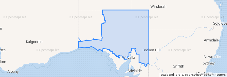
Pastoral Unincorporated Area
Pastoral Unincorporated Area
Constitutes 63% of the land area of the State of South Australia
در نقشه تعاملی مشاهده کنید
مسیرهای حمل و نقل عمومی
The Ghan
Train Indian Pacific
Train Indian Pacific
ایستگاه
Cook
نقاط مورد علاقه
Manna Hill Police Station
Olary Hotel
Yunta Centenary Park
Municipal Council of Roxby Downs
The District Council of Coober Pedy
Olary Hotel
Olary Rest Area
Spuds Roadhouse
Ampol 24hr Card
RFDS Clinic Yunta
Perrys 24Hr Card
Hunts Fuel
Fuel- Automated Diesel
Yunta Police Station
Mannahill Hotel
Yunta Rural School
Yunta District Hall Inc.
Mannahill Rest Area
Yunta
Yunta Post Office
Mannahill Hotel
Cockburn Police Station
Yunta Hotel
Mobil
Mannahill Rest Area
Pastoral Unincorporated Area
Ampol Yunta
Kingoonya
Mobil 24hr Card
Mobil