Oturum aç
Yıldız kullanıcılar
Anket
anasayfa
>
Brezilya
>
Güney bölgesi
>
Rio Grande do Sul
>
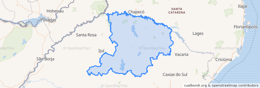
Região Geográfica Intermediária de Passo Fundo
Região Geográfica Intermediária De Passo Fundo
Etkileşimli haritada görüntüle
Toplu taşıma yolları
Cruz Alta → Santa Maria
Cruz Alta → Santa Maria
Erechim → Santa Maria via BR-285
Santa Maria → Cruz Alta
Santa Maria → Cruz Alta
Santa Maria → Erechim via BR-285
Santa Maria → Santo Ângelo
Santa Maria → Santo Ângelo
Santa Maria → Tupanciretã
Santa Maria → Tupanciretã
Santa Rosa → Santa Maria via RS-344 e Cruz Alta
Santo Ângelo → Santa Maria
Santo Ângelo → Santa Maria
Tupanciretã → Santa Maria
Tupanciretã → Santa Maria
Yerler
Região Geográfica Imediata de Cruz Alta
(15)
Região Geográfica Imediata de Carazinho
(2)
Região Geográfica Imediata de Erechim
(2)
Região Geográfica Imediata de Passo Fundo
(2)
Nova Alvorada
(0)
Região Geográfica Imediata de Frederico Westphalen
(0)
Região Geográfica Imediata de Lagoa Vermelha
(0)
Região Geográfica Imediata de Marau
(0)
Região Geográfica Imediata de Nonoai
(0)
Região Geográfica Imediata de Palmeira das Missões
(0)
Região Geográfica Imediata de Soledade
(0)
Região Geográfica Imediata de Tapejara - Sananduva
(0)
Trindade do Sul
(0)
Durur
Rodoviária de Tupanciretã
Rodoviária de Erechim
Rodoviária de Cruz Alta
İlgi noktaları
Centro Social e Assistencial
Prefeitura Municipal de Tupanciretã
Pinhal
Erebango
Dois Irmãos das Missões
Banco24Horas
Camargo
Alpestre
David Canabarro
Vista Alegre
Broka's FOOD
Pontão
Santo Expedito do Sul
Getúlio Vargas
São Valentim
Alto Alegre
Três Palmeiras
Trindade do Sul
Floriano Peixoto
Marau
Igreja Universal do Reino de Deus
Restaurante Sollares
Ametista do Sul
Região Geográfica Imediata de Carazinho
Centro de Eventos Érico Veríssimo
Santa Cecília do Sul
Ponto Taxi Rodoviária
Soledade
Cruzaltense
Região Geográfica Imediata de Erechim