Login
Star users
Poll
Home
>
United States
>
Colorado
>
Mesa County
>
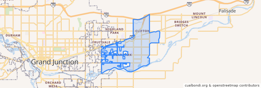
Clifton
Clifton
See in interactive map
Routes of public transport
Route 10 Clifton
Route 2 Patterson Road
Route 3 - Orchard Avenue
Route 4 - Palisade
Route 9 - North Avenue
Stops
32 1/2 Road + South of E 1/2 Road
32 Road + South of D 1/2 Road
D 1/2 Road + West of Pera Street
32 1/2 Road + South of Lucile Avenue
32 Road + Elm Avenue
D Road + West of 31 1/2 Road
32 Road + D 3/4 Road
E 1/2 Road + East of Honeycomb Lane
33 Road + North of E Road
D 1/2 Road + East of 32 3/8 Road
D Road + Crystal Drive
D Road + West of Roberts Road
D Road + West of Wedgewood Avenue
33 Road + North of San Felipe Avenue
D 1/2 Road + West of 32 Road
E 1/2 Road + East of Primavera Street
32 1/2 Road + North of E Road
D Road + West of Riverwood Drive
1st Street + Grand Avenue
Highway 6 + East of Lois Street (NO SIGN)
E 1/2 Road + West of 32 Road (Coronado Plaza)
D 1/2 Road + West of 33 Road
32 Road + Kennedy Avenue
32 Road + North of D 1/2 Road
D 1/2 Road + Clear Creek Drive
E Road + East of Green Acres Street
32 Road + North of E Road (Gas Station)
D Road + East of Alamo Street
D 1/2 Road + West of Carson Lake Drive
Clifton Transfer Station
Points of interest
Chin Chin Chinese Restaurant
Jimmy John's
Light and Life Chapel
Graystone Winery
Papa John's
Clifton