Login
Star users
Poll
Home
>
United States
>
New York
>
Albany County
>
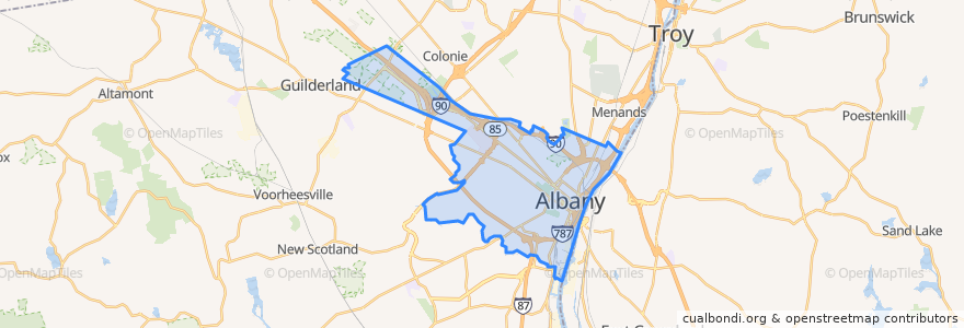
Albany
Albany
See in interactive map
Routes of public transport
CDTA 100 Mid City Belt
CDTA 114 Madison/Washington
CDTA 116 Mount Hope/Albany South End
CDTA 11 UAlbany Shuttle
CDTA 138 Allen/Livingston
CDTA 224 Albany-HVCC-Troy via Route 4
CDTA 233 Albany/Schodack
CDTA 520 Albany/Nassau Express
CDTA 531 St. Luke's/Woodlawn Park & Ride Express
CDTA 6 Second/Whitehall
CDTA 7 Glenmont
CDTA 870 Capital City Trolley
Stops
-73.7917322, 42.666394000000004
Core 1
-73.7878563, 42.665336700000005
S. Swan St & Washington Ave
Washington Ave & Hawk St - Capitol/Hawk Station
State St & S. Pearl St - S. Pearl Station
Broadway & Peter D Kiernan Plaza
-73.79167430000001, 42.6665441
-73.77401640000001, 42.6609148
Madison Ave & Empire State Plaza
-73.7745326, 42.6609068
-73.7820097, 42.6635253
Points of interest
Subway
Evangelical Protestant Church
Madison & Lark
Washington Avenue Parking Garage
The Barrel Saloon
Trinbago Caribbean Restaurant and Pho Queen
New No. 1 Chinese Restaurant
Frios
Stacks Espresso Bar
Crossgates Restaurant and Banquet House
Ben & Jerry’s
LAX Restaurant and Lounge
Capitol Melts
Jennings Landing
Henry Hudson Panetarium
Outpatient Pharmacy
Albany Bible Institute
Charter Restaurant
Saint James Institute
Pastanini
Recovery Room Sports Grill
Saint Mathew Evangelical Lutheran Church
Hudson Riverway Park - Corning Preserve
Andy's Place
Tanpopo Ramen and Sake Bar
Thatcher Street Pub
First Church of Christ Scientist
The Pub
Tech Valley High School
Wicked Wings N Things