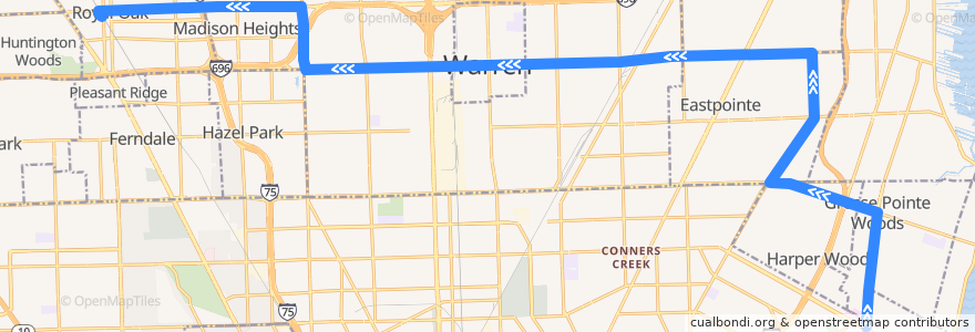
Itinerario 730 WB: Mack/Moross => Royal Oak
Luoghi nel percorso
Punti di interesse vicino al percorso
Fermate:
- -83.1399092, 42.489935200000005
- 11 Mile / Vermont (WB)
- 10 Mile / Groesbeck NS (WB)
- 10 Mile / Eureka (WB)
- 10 Mile / Thomas (WB)
- -83.104427, 42.490868500000005
- Mack / Colonial (NB)
- 10 Mile / Ford (WB)
- -83.05608260000001, 42.4769755
- 10 Mile / Schoenherr (WB)
- -83.125045, 42.4903512
- -82.90852480000001, 42.4322816
- -83.0426771, 42.477169800000006
- -82.9266348, 42.4680096
- 10 Mile / Gratiot (WB)
- -82.93213920000001, 42.449787
- -82.94609580000001, 42.479731
- -83.0801582, 42.4764232
- 11 Mile / Nanton (WB)
- -82.9795813, 42.478771900000005
- Mack / Bournemouth (NB)
- -83.1377939, 42.489997100000004
- 10 Mile / Campbell (WB)
- -82.9079598, 42.443966800000005
- -82.9339691, 42.450229500000006
- -82.993936, 42.4781355
- Mack / Shelbourne (NB)
- -82.92762090000001, 42.4802459
- -82.909197, 42.4283312
- -83.0861558, 42.4907677
- Eleven Mile / Madison High School (WB)
- 8 Mile / Emile (WB)
- 11 Mile / Alger (WB)
- -82.9556127, 42.479624900000005
- 10 Mile / Send (WB)
- Kelly / Toepfer NS (NB)
- Kelly / Ash (NB)
- 10 Mile / Westbrook (WB)
- 10 Mile / Hoover (WB)
- 10 Mile / Fern (WB)
- Mack / Lochmoor (NB)
- -82.9873591, 42.478258600000004
- -82.9428237, 42.4798059
- Dequindre / Tobsal NS (NB)
- -83.0099916, 42.477810500000004
- -83.02794080000001, 42.477434800000005
- 10 Mile / Pineview (WB)
- -83.13308330000001, 42.490138900000005
- Kelly / Oak (NB)
- -82.9401095, 42.4798719
- -83.02471170000001, 42.477491900000004
- -82.9100544, 42.4211279
- 11 Mile / Osmun (WB)
- -82.91044980000001, 42.4176431
- -83.0501924, 42.47708
- -82.9383775, 42.4528219
- -82.90952580000001, 42.4259149
- -83.0230647, 42.4775098
- Kelly / Forest (NB)
- -83.05861990000001, 42.476911900000005