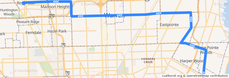
Route 730 WB: Mack/Moross => Royal Oak
Places that travel to
Points of interest near the route
Stops:
- Kelly / Forest (NB)
- -82.92673860000001, 42.4711197
- -82.9140289, 42.4454276
- -82.9077693, 42.4377258
- -82.9265706, 42.4659003
- 10 Mile / Schoenherr (WB)
- 10 Mile / Fern (WB)
- Vernier / Helen (WB)
- 11 Mile / Curry NS (WB)
- -82.9697751, 42.479397600000006
- Mack / Colonial (NB)
- -83.0520809, 42.4770495
- -82.9342136, 42.4800367
- -82.909197, 42.4283312
- -82.9674461, 42.479524100000006
- 10 Mile / Warner (WB)
- 11 Mile / Hales (WB)
- 11 Mile / Troy (WB)
- 10 Mile / Thomas (WB)
- 10 Mile / Gratiot NS (WB)
- 10 Mile / Beierman (WB)
- 11 Mile / John R NS (WB)
- 11 Mile / Alger (WB)
- 10 Mile / Westbrook (WB)
- 10 Mile / Comfort (WB)
- Eleven Mile / Hampden (WB)
- Mack / Oxford (NB)
- 10 Mile / Tecla (WB)
- Mack / Allard (NB)
- 10 Mile / Pineview (WB)
- Kelly / Toepfer NS (NB)
- -82.981238, 42.4786517
- 10 Mile / Automobile (WB)
- 10 Mile / Send (WB)
- -82.9100544, 42.4211279
- -82.92762090000001, 42.4802459
- 10 Mile / Rosalind (WB)
- 10 Mile / Groesbeck NS (WB)
- -82.957474, 42.479608500000005
- Mack / Moross (NB)
- -82.9428237, 42.4798059
- -82.9360096, 42.4553075
- -83.1399092, 42.489935200000005
- Kelly / Ego (NB)
- 10 Mile / Burt (WB)
- 10 Mile / Hoover (WB)
- -82.9845205, 42.47842
- 11 Mile / Nanton (WB)
- Kelly / Spindler (NB)
- -82.92836240000001, 42.463410100000004
- -82.993936, 42.4781355
- -83.05375450000001, 42.4770254
- Vernier / Beaconsfield (WB)
- 10 Mile / Easy (WB)
- 11 Mile / Vermont (WB)
- Mack / Cook (NB)
- -83.0501924, 42.47708
- -83.14264560000001, 42.489870800000006
- -83.1141097, 42.490633100000004
- -82.94609580000001, 42.479731