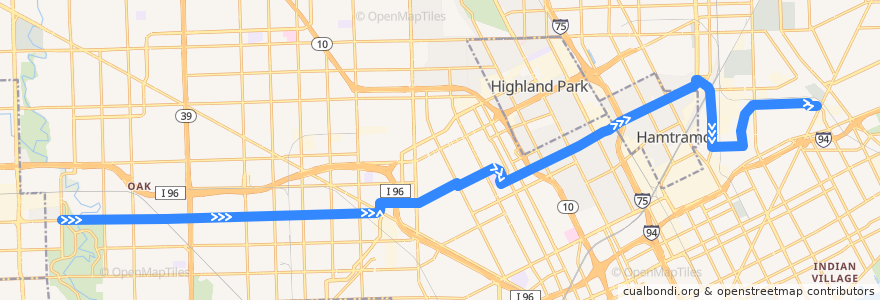
Route 38 EB: Outer Dr => Gratiot
Places that travel to
Points of interest near the route
Stops:
- Plymouth / Heyden (EB)
- Caniff / Joseph Campau (EB)
- -83.0722822, 42.394971500000004
- Mt Elliott / Marcus (SB)
- -83.24601, 42.3718318
- -83.23930150000001, 42.371870900000005
- La Salle / Webb (SB)
- -83.1616599, 42.3734253
- -83.09180350000001, 42.387354200000004
- Plymouth / Outer Dr (EB)
- Caniff / Conant (EB)
- Calvert / 3rd (EB)
- -83.03165050000001, 42.3904129
- -83.026852, 42.3958193
- -83.1715262, 42.373157000000006
- -83.017359, 42.40092
- -83.0799362, 42.391748500000006
- -83.1096498, 42.3807732
- Plymouth / Greenfield (EB)
- -83.1583662, 42.3735098
- Traverse / French NS (EB)
- -83.1442416, 42.376050400000004
- Plymouth / Indiana (EB)
- -83.1776567, 42.3730435
- -83.1950856, 42.372629800000006
- Plymouth / Montrose (EB)
- Caniff / Russell (EB)
- Tuxedo / Dexter (EB)
- -83.16666740000001, 42.3732823
- Caniff / Cardoni (EB)
- -83.0674791, 42.3969953
- Elmhurst / Oakman (EB)
- Elmhurst / Broadstreet (EB)
- -83.2019211, 42.3725006
- -83.1740168, 42.3731079
- Plymouth / Sorrento (EB)
- -83.11035700000001, 42.384044
- Plymouth / Grandville (EB)
- Elmhurst / Livernois (EB)
- Plymouth / Appoline (EB)
- -83.0470162, 42.404546200000006
- Plymouth / Whitcomb (EB)
- -83.22264770000001, 42.3721389
- -83.03766350000001, 42.400294800000005
- -83.09484710000001, 42.3862121
- -83.0437546, 42.405794
- Caniff / Grand Haven (EB)
- Grinnell / Erwin (EB)
- Caniff / Cameron (EB)
- Plymouth / Greenview (EB)
- -83.20447460000001, 42.3724739
- Plymouth / Braile (EB)
- Plymouth / Penrod (EB)
- -83.08895770000001, 42.388426
- Grinnell / Van Dyke (EB)
- -83.1338683, 42.3775537
- Calvert / Byron (EB)
- Plymouth / Southfield (EB)
- -83.0595576, 42.399910600000005
- Elmhurst / American (EB)