Login
Star users
Poll
Home
>
United States
>
Maryland
>
Baltimore
Baltimore
See in interactive map
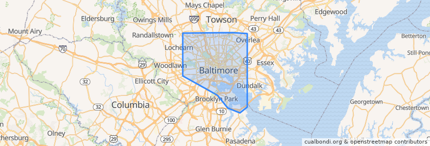
Routes of public transport
Baltimore Light RailLink: BWI Airport → Hunt Valley
Baltimore Light RailLink: Camden Yards → Penn Station
Baltimore Light RailLink: Fairgrounds → Glen Burnie
Baltimore Light RailLink: Glen Burnie → Fairgrounds
Baltimore Light RailLink: Hunt Valley → BWI Airport
Baltimore Light RailLink: Penn Station → Camden Yards
Baltimore Metro SubwayLink: Johns Hopkins → Owings Mills
Baltimore Metro SubwayLink: Owings Mills → Johns Hopkins
Charm City Circulator Banner Route
Charm City Circulator Orange Route
Charm City Circulator Purple Route
CityLink Blue: Bayview
CityLink Blue: CMS
CityLink Blue: Westgate (North Bend)
CityLink Brown: Overlea
CityLink Brown: University of Maryland Medical Center
CityLink Brown: White Marsh
CityLink Gold: Berea (Baltimore Cemetery)
CityLink Gold: Canton
CityLink Gold: Walbrook Junction
CityLink Green: Inner Harbor
CityLink Green: Towson
CityLink Lime: Druid Hill Park
CityLink Lime: Harbor East
CityLink Lime: Northwest Hospital
CityLink Navy: Dundalk (Center Place)
CityLink Navy: Mondawmin Metro Station
CityLink Navy: Watersedge (Bullneck Road)
CityLink Pink: Cedonia
CityLink Pink: West Baltimore
CityLink Purple: Catonsville
CityLink Purple: Johns Hopkins Hospital
CityLink Purple: Paradise
CityLink Red: Lutherville Light Rail Stop
CityLink Red: Towson Town Center
CityLink Red: University of Maryland Transit Center
CityLink Silver: Curtis Bay
CityLink Silver: Johns Hopkins University
CityLink Silver: Morgan State University
CityLink Yellow: Beltway Business Community
CityLink Yellow: Mondawmin
CityLink Yellow: Riverview
CityLink Yellow: UMBC via Kaiser
Commuter Bus 210: Annapolis
Commuter Bus 210: Downtown Baltimore (from Annapolis)
Commuter Bus 210: Downtown Baltimore (from Kent Island)
Commuter Bus 210: Kent Island
Commuter Bus 215: Annapolis
Commuter Bus 215: Baltimore
Commuter Bus 310: Columbia
Commuter Bus 310: Downtown Baltimore
Commuter Bus 320: Downtown Baltimore (trips 8;10;12)
Commuter Bus 410: Churchville/Bel Air
Commuter Bus 411: Hickory/Bel Air
Commuter Bus 420: Havre de Grace (trip A via White Marsh)
Commuter Bus 420: Havre de Grace (trips 6-10)
Express Bus 103: Cromwell Bridge Road
Express Bus 103: Inner Harbor
Express Bus 105: Cedonia
Express Bus 110: Light Street
Express Bus 110: US 40 & Rolling Road
Express Bus 115: Paca Street
Express Bus 115: Perry Hall
Express Bus 120 (AM): Johns Hopkins Hospital
Express Bus 120 (AM Reverse): White Marsh Park & Ride
Express Bus 120 (PM Reverse): Johns Hopkins Hospital
Express Bus 120 (PM): White Marsh Park & Ride
Express Bus 150: Columbia
Express Bus 150: Downtown/Harbor East
Express BusLink 105: Downtown
Express BusLink 154: Carney
Express BusLink 154: Goucher & Taylor
Express BusLink 154: State Center
Express BusLink 164: City Hall
Express BusLink 164: Riviera Beach
Flixbus 2601: New York City => Richmond
Flixbus 2601: New York City => Rosslyn
Flixbus 2601: Richmond => New York City
Flixbus 2601: Rosslyn => New York City
Flixbus 2602: New York City => Washington, D.C.
Flixbus 2602: Washington, D.C. => New York City
Flixbus N2610: Boston => Washington, D.C.
Flixbus N2610: Washington, D.C. => Boston
LocalLink 21: Canton Crossing
LocalLink 21: Woodberry
LocalLink 22: Bayview Medical Center
LocalLink 22: Mondawmin Metro Station
LocalLink 26: Mondawmin
LocalLink 26: South Baltimore Park & Ride
LocalLink 29: Brooklyn
LocalLink 29: Mondawmin
LocalLink 30: Rogers Avenue
LocalLink 30: Rosedale Industrial Park
LocalLink 31: Security Square
LocalLink 31: Sinai Hospital
LocalLink 31: Social Security
LocalLink 33: Mount Washington
LocalLink 33: Overlea
LocalLink 34: Falls Road
LocalLink 34: Westview
LocalLink 52: Greenmount North
LocalLink 52: Stella Maris
LocalLink 53: Hillendale
LocalLink 53: Sheppard Pratt
LocalLink 53: State Center
LocalLink 54: Carney
LocalLink 54: Goucher & Taylor
LocalLink 54: State Center
LocalLink 56: Charles Center
LocalLink 56: White Marsh Mall
LocalLink 56: White Marsh Park & Ride
LocalLink 57: Belair-Edison Loop (Big Loop)
LocalLink 57: Belair-Edison Loop (Small Loop)
LocalLink 63: Bayview
LocalLink 63: Inner Harbor
LocalLink 63: Tradepoint Atlantic
LocalLink 65: CCBC Dundalk
LocalLink 65: Charles Center
LocalLink 67: City Hall
LocalLink 67: Marley Neck
LocalLink 69: Jumpers Hole
LocalLink 69: Patapsco
LocalLink 69: UM Transit Center
LocalLink 70: Annapolis
LocalLink 70: Patapsco
LocalLink 70: UM Transit Center
LocalLink 71: Lexington Market
LocalLink 71: Patapsco
LocalLink 73: Charles Center
LocalLink 73: Patapsco
LocalLink 76: Southwest Park & Ride
LocalLink 77: Catonsville (Route 40 & Rolling Road)
LocalLink 77: West Baltimore
LocalLink 78: CMS
LocalLink 78: West Baltimore
LocalLink 79: CMS
LocalLink 79: Mondawmin
LocalLink 80: City Hall
LocalLink 80: Rogers Avenue
LocalLink 82: Park Circle (Monte Verde)
LocalLink 82: Reisterstown Plaza
LocalLink 85: Milford Mill
LocalLink 85: Penn-North
LocalLink 91: Mondawmin
LocalLink 91: Sinai Hospital
LocalLink 94: Fort McHenry
LocalLink 94: Sinai Hospital
LocalLink 95: Inner Harbor
LocalLink 95: Roland Park (Bellemore)
MARC Camden Line: Baltimore => Washington
MARC Camden Line: Washington => Baltimore
MARC Penn Line: Perryville => Washington
Stops
Park Heights Avenue & Druid Park Drive Far-side Northbound
Charles Street & Conway Street
-76.6158671, 39.3008827
41st Street & Girard Avenue Westbound
-76.60989140000001, 39.35533
-76.63612640000001, 39.3378517
-76.6095919, 39.3432497
Fulton Avenue & Reisterstown Road Far-side Northbound
-76.5967669, 39.366465500000004
Rogers Avenue
Mondawmin
Saint Paul Street & 31st Street Southbound
-76.6342614, 39.3677056
Charles Street at Biddle
Saint Paul Street & North Avenue Far-side Southbound
-76.5497077, 39.301244000000004
Reisterstown Road & Ocala Avenue Northbound
Reisterstown Road & Windsor Avenue Southbound
-76.60303090000001, 39.3648219
Falls Road & Cross Keys Opposite Northbound
Roland Avenue & Cold Spring Lane Southbound
York Road & Radnor Road Southbound
Pratt Street & Market Place Opposite Far-side Eastbound
North Avenue & Eutaw Place Westbound
Pleasant Street
York Road & 43rd Street Opposite Southbound
Glen Avenue & Clover Road Westbound
Reisterstown Road & Ruskin Avenue Northbound
Falls Road & 41st Street Northbound
-76.53967870000001, 39.3042178
Points of interest
Hampden Christian School
Kingsway Bible Baptist Church
Marty's Deli
Emmanuel Reformed Episcopal Church
Toss
The MarketPlace at Sinai
CFG Community Bank
Dunkin' Donuts
St. Francis Neighborhood Center
Father Charles Hall Catholic Elementary School
Papa John's
Mechanic Theater (Historic)
Saint Pauls Roman Catholic Church
Nina’s
Canton Pretzel Store
Petit Louis
Jewel Box
Mount Moriah Baptist Church
Uncle Lee's Restaurant
Suspended Brewery
Sugarbee's Gourmet Panini Grill
Kooper's Tavern
Deeper Life Bible Church
Grove Park Elementary School
Star of Bethlehem African Methodist Episcopal Church
Char'd CIty
Cafe on the Square
Community Evangelical Church
Little Caesars
Star of Bethlehem Spiritual Temple