ログインする
スターユーザー
投票
ホーム
>
アメリカ合衆国
>
メリーランド州
>
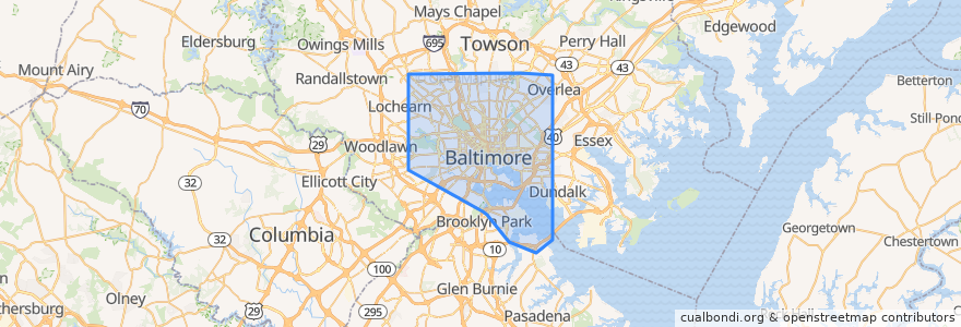
Baltimore
Baltimore
インタラクティブマップで見る
公共交通機関のルート
Baltimore Light RailLink: BWI Airport → Hunt Valley
Baltimore Light RailLink: Camden Yards → Penn Station
Baltimore Light RailLink: Fairgrounds → Glen Burnie
Baltimore Light RailLink: Glen Burnie → Fairgrounds
Baltimore Light RailLink: Hunt Valley → BWI Airport
Baltimore Light RailLink: Penn Station → Camden Yards
Baltimore Metro SubwayLink: Johns Hopkins → Owings Mills
Baltimore Metro SubwayLink: Owings Mills → Johns Hopkins
Charm City Circulator Banner Route
Charm City Circulator Orange Route
Charm City Circulator Purple Route
CityLink Blue: Bayview
CityLink Blue: CMS
CityLink Blue: Westgate (North Bend)
CityLink Brown: Overlea
CityLink Brown: University of Maryland Medical Center
CityLink Brown: White Marsh
CityLink Gold: Berea (Baltimore Cemetery)
CityLink Gold: Canton
CityLink Gold: Walbrook Junction
CityLink Green: Inner Harbor
CityLink Green: Towson
CityLink Lime: Druid Hill Park
CityLink Lime: Harbor East
CityLink Lime: Northwest Hospital
CityLink Navy: Dundalk (Center Place)
CityLink Navy: Mondawmin Metro Station
CityLink Navy: Watersedge (Bullneck Road)
CityLink Pink: Cedonia
CityLink Pink: West Baltimore
CityLink Purple: Catonsville
CityLink Purple: Johns Hopkins Hospital
CityLink Purple: Paradise
CityLink Red: Lutherville Light Rail Stop
CityLink Red: Towson Town Center
CityLink Red: University of Maryland Transit Center
CityLink Silver: Curtis Bay
CityLink Silver: Johns Hopkins University
CityLink Silver: Morgan State University
CityLink Yellow: Beltway Business Community
CityLink Yellow: Mondawmin
CityLink Yellow: Riverview
CityLink Yellow: UMBC via Kaiser
Commuter Bus 210: Annapolis
Commuter Bus 210: Downtown Baltimore (from Annapolis)
Commuter Bus 210: Downtown Baltimore (from Kent Island)
Commuter Bus 210: Kent Island
Commuter Bus 215: Annapolis
Commuter Bus 215: Baltimore
Commuter Bus 310: Columbia
Commuter Bus 310: Downtown Baltimore
Commuter Bus 320: Downtown Baltimore (trips 8;10;12)
Commuter Bus 410: Churchville/Bel Air
Commuter Bus 411: Hickory/Bel Air
Commuter Bus 420: Havre de Grace (trip A via White Marsh)
Commuter Bus 420: Havre de Grace (trips 6-10)
Express Bus 103: Cromwell Bridge Road
Express Bus 103: Inner Harbor
Express Bus 105: Cedonia
Express Bus 110: Light Street
Express Bus 110: US 40 & Rolling Road
Express Bus 115: Paca Street
Express Bus 115: Perry Hall
Express Bus 120 (AM): Johns Hopkins Hospital
Express Bus 120 (AM Reverse): White Marsh Park & Ride
Express Bus 120 (PM Reverse): Johns Hopkins Hospital
Express Bus 120 (PM): White Marsh Park & Ride
Express Bus 150: Columbia
Express Bus 150: Downtown/Harbor East
Express BusLink 105: Downtown
Express BusLink 154: Carney
Express BusLink 154: Goucher & Taylor
Express BusLink 154: State Center
Express BusLink 164: City Hall
Express BusLink 164: Riviera Beach
Flixbus 2601: New York City => Richmond
Flixbus 2601: New York City => Rosslyn
Flixbus 2601: Richmond => New York City
Flixbus 2601: Rosslyn => New York City
Flixbus 2602: New York City => Washington, D.C.
Flixbus 2602: Washington, D.C. => New York City
Flixbus N2610: Boston => Washington, D.C.
Flixbus N2610: Washington, D.C. => Boston
LocalLink 21: Canton Crossing
LocalLink 21: Woodberry
LocalLink 22: Bayview Medical Center
LocalLink 22: Mondawmin Metro Station
LocalLink 26: Mondawmin
LocalLink 26: South Baltimore Park & Ride
LocalLink 29: Brooklyn
LocalLink 29: Mondawmin
LocalLink 30: Rogers Avenue
LocalLink 30: Rosedale Industrial Park
LocalLink 31: Security Square
LocalLink 31: Sinai Hospital
LocalLink 31: Social Security
LocalLink 33: Mount Washington
LocalLink 33: Overlea
LocalLink 34: Falls Road
LocalLink 34: Westview
LocalLink 52: Greenmount North
LocalLink 52: Stella Maris
LocalLink 53: Hillendale
LocalLink 53: Sheppard Pratt
LocalLink 53: State Center
LocalLink 54: Carney
LocalLink 54: Goucher & Taylor
LocalLink 54: State Center
LocalLink 56: Charles Center
LocalLink 56: White Marsh Mall
LocalLink 56: White Marsh Park & Ride
LocalLink 57: Belair-Edison Loop (Big Loop)
LocalLink 57: Belair-Edison Loop (Small Loop)
LocalLink 63: Bayview
LocalLink 63: Inner Harbor
LocalLink 63: Tradepoint Atlantic
LocalLink 65: CCBC Dundalk
LocalLink 65: Charles Center
LocalLink 67: City Hall
LocalLink 67: Marley Neck
LocalLink 69: Jumpers Hole
LocalLink 69: Patapsco
LocalLink 69: UM Transit Center
LocalLink 70: Annapolis
LocalLink 70: Patapsco
LocalLink 70: UM Transit Center
LocalLink 71: Lexington Market
LocalLink 71: Patapsco
LocalLink 73: Charles Center
LocalLink 73: Patapsco
LocalLink 76: Southwest Park & Ride
LocalLink 77: Catonsville (Route 40 & Rolling Road)
LocalLink 77: West Baltimore
LocalLink 78: CMS
LocalLink 78: West Baltimore
LocalLink 79: CMS
LocalLink 79: Mondawmin
LocalLink 80: City Hall
LocalLink 80: Rogers Avenue
LocalLink 82: Park Circle (Monte Verde)
LocalLink 82: Reisterstown Plaza
LocalLink 85: Milford Mill
LocalLink 85: Penn-North
LocalLink 91: Mondawmin
LocalLink 91: Sinai Hospital
LocalLink 94: Fort McHenry
LocalLink 94: Sinai Hospital
LocalLink 95: Inner Harbor
LocalLink 95: Roland Park (Bellemore)
MARC Camden Line: Baltimore => Washington
MARC Camden Line: Washington => Baltimore
MARC Penn Line: Perryville => Washington
ストップ
Reisterstown Road & Fulton Avenue
Park Heights Avenue & Springhill Avenue Southbound
West Baltimore
Dundalk Marine Terminal
-76.60147070000001, 39.328538900000005
Roland Avenue & Bellmore Road Far-side Southbound
Reisterstown Road & Windsor Avenue Southbound
Fulton Avenue & Clifton Avenue Northbound
-76.6593943, 39.346387500000006
-76.5373191, 39.3582332
York Road & Lortz Lane Southbound
Park Heights Avenue & Trainor Avenue Southbound
-76.6130933, 39.281891900000005
York Road & Winston Avenue Far-side Northbound
-76.56016790000001, 39.3660398
Fulton Avenue & North Avenue Southbound
Key Highway
-76.5811913, 39.3059487
Falls Road & Northern Parkway Southbound
-76.5888335, 39.3123969
Reisterstown Road & Liberty Heights Avenue Northbound
Charles Street & Pratt Street Northbound
-76.5691365, 39.2865429
Park Heights Avenue & Rogers Avenue Northbound
Fulton Avenue & Reisterstown Road Far-side Northbound
State Center/Cultural Center
Pratt Street & South Street Eastbound
Pulaski Highway & Moravia Park Drive Eastbound
Pennsylvania Avenue & Cumberland Street Northbound
Pennsylvania Avenue & North Avenue Southbound
興味がある点
Friendship Baptist Church
Thai Restaurant
Johnny Rad's Pizzeria Tavern
THB Bagelty & Deli
Nicodemus Baptist Church
Chinquapin Middle School
Vivien T Thomas Medical Arts Academy
Five Guys
United Bible Way Church
Hudson Street Stackhouse
Baltimore Fire Station 6
Vino Wine Bar & Shop
Matthew's Pizza
Sofi's Crepes
KFC/Long John Silver’s
Calvary Chapel Church of God
Blessed Baptist Church of God
Nam Kang Restaurant
&pizza
Church of the Redeemer Day School
Dr Rayner Browne Elementary School
Kiddie Castle Child Development
McKim's Free School
Little Free Library
Grace Christian Baptist Church
East Baltimore Baptist Church
Kimmy's Soul Food
Kooper's Tavern
O'Donnell's Pub & Grill
Zhongshan Restaurant