Login
Star users
Poll
Home
>
United States
>
Kansas
>
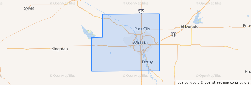
Sedgwick County
Sedgwick County
See in interactive map
Routes of public transport
Route 24
Places
Wichita
(1)
Andale
(0)
Bel Aire
(0)
Bentley
(0)
Cheney
(0)
Clearwater
(0)
Colwich
(0)
Derby
(0)
Eastborough
(0)
Garden Plain
(0)
Goddard
(0)
Haysville
(0)
Kechi
(0)
Maize
(0)
Mount Hope
(0)
Oaklawn-Sunview
(0)
Park City
(0)
Valley Center
(0)
Viola
(0)
Points of interest
Reverie Coffee Roasters
Hyde Magnet School
Sedgwick County
Bar
Viola
Jimmy's Egg
Heroes
West Haysville Baptist Church
Pumphouse
Colwich
Redeemer Lutheran Church
Piatto Neapolitan Pizzeria
Goddard
Garden Plain
Wichita Fire Department Battalion 9
Mount Hope
Kansas Bureau of Investigations
Playa Azul
Emerson Biggin's
District Taqueria
Hyde Elementary School
First Southern Baptist Church
Bel Aire
Mulvane
Mead's Corner
Oaklawn-Sunview
River City Brewing Co.
Farbique School
Beacon Restaurant
Christian Community of Wichita