Login
Star users
Poll
Home
>
United States
>
Georgia
>
Clayton County
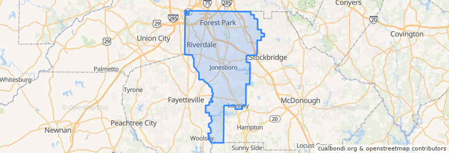
Clayton County
See in interactive map
Routes of public transport
ATL SkyTrain: Aeroport → Rental Car Center
ATL SkyTrain: Rental Car Center → Aeroport
MARTA 172 Sylvan Road/Virginia Avenue
MARTA 800 Lovejoy
Subway Gold Line: Airport Station => Doraville
Subway Gold Line: Doraville => Airport Station
Subway Red Line: Airport Station => North Springs
Subway Red Line: North Springs => Airport Station
The Plane Train: Concourse F → Domestic Baggage Claim
The Plane Train: Domestic Baggage Claim → Concourse F
Xpress 431 BrandsMart/Stockbridge to Midtown
Places
Forest Park
(1)
Jonesboro
(1)
Lovejoy
(1)
Morrow
(1)
Lake City
(0)
Riverdale
(0)
Stops
F Gates & International Terminal
-84.4462881, 33.6407165
Domestic Terminal
A Gates
-84.4461445, 33.6407176
GICC/Gateway Center
Airport Station
Airport Station
T Gates
GICC/Gateway Center
C Gates
B Gates
E Gates
D Gates
Points of interest
Auntie Anne's
Terminal North Gold Lot
Best Buy Express
Famous Famiglia
Einstein Bros. Bagels
Delta Skyclub Lounge
Krystal
Wells Fargo
South Metro Fellowship Church
Subway
Chick-fil-A
IHOP
TGI Friday's
Chick-fil-A
Starbucks
Jekyll Island
Coca-Cola vending
Cafe Intermezzo
Travelex
McDonald's
Popeyes
State Farmer's Market
Willy's Mexicana
FedEx Express
Phillips seafood
Freshëns
Panda Express
Proof of the Pudding
Cafe Tazza
Arby's