Oturum aç
Yıldız kullanıcılar
Anket
anasayfa
>
Amerika Birleşik Devletleri
>
Georgia
>
Clayton County
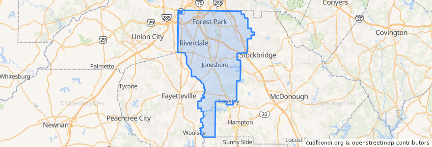
Clayton County
Etkileşimli haritada görüntüle
Toplu taşıma yolları
ATL SkyTrain: Aeroport → Rental Car Center
ATL SkyTrain: Rental Car Center → Aeroport
MARTA 172 Sylvan Road/Virginia Avenue
MARTA 800 Lovejoy
Subway Gold Line: Airport Station => Doraville
Subway Gold Line: Doraville => Airport Station
Subway Red Line: Airport Station => North Springs
Subway Red Line: North Springs => Airport Station
The Plane Train: Concourse F → Domestic Baggage Claim
The Plane Train: Domestic Baggage Claim → Concourse F
Xpress 431 BrandsMart/Stockbridge to Midtown
Yerler
Forest Park
(1)
Jonesboro
(1)
Lovejoy
(1)
Morrow
(1)
Lake City
(0)
Riverdale
(0)
Durur
-84.4462881, 33.6407165
E Gates
A Gates
C Gates
Airport Station
D Gates
B Gates
GICC/Gateway Center
Airport Station
T Gates
Domestic Terminal
GICC/Gateway Center
F Gates & International Terminal
-84.4461445, 33.6407176
İlgi noktaları
Popeyes
Phillips seafood
Lottafruit
Mount Zion Elementary School
Coca-Cola vending
Freshens
Clayton County
Delta Skyclub Lounge
Blue Moon Brewhouse
Mount Zion Cemetery
Brews and Blues
Georgia Station Patrol Post 47 Police Station
Proof of the Pudding
Forest Park
Coca-Cold
Morrow
Travelex
Arby's
food network kitchen
Delta Skyclub Lounge
Atlanta Chophouse
South Metro Fellowship Church
Garbonzo Grill
Chick-fil-A
TGI Friday's
Pinkberry
Jonesboro Church of God
Passports
Asian Chao
Atlanta Hawks Highlight Factory