وارد شدن
کاربران ستاره
نظرسنجی
شروع
>
استرالیا
>
Western Australia
>
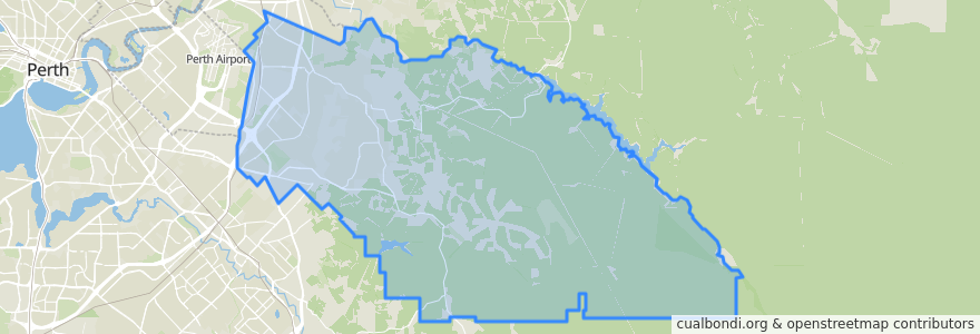
City Of Kalamunda
City Of Kalamunda
در نقشه تعاملی مشاهده کنید
مسیرهای حمل و نقل عمومی
270F Elizabeth Quay Bus Station → High Wycombe Station
270T High Wycombe Station → Elizabeth Quay Bus Station
280F High Wycombe Station → Westfield Carousel
280T Westfield Carousel → High Wycombe Station
293F Redcliffe → High Wycombe
293T High Wycombe → Redcliffe
294F High Wycombe → Foodbank WA
294T Foodbank WA → High Wycombe
Airport Line: Claremont → High Wycombe
Airport Line: High Wycombe → Claremont
ایستگاه
Dundas Road before Wittenoom Road
Abernethy Road opposite Rail Freight Terminal
Berkshire Road before Ashby Close
Hale Road before Strelitzia Avenue
Berkshire Road before Bougainvillea Avenue
Abernethy Road after Hudswell Road
Berkshire Road before Apricot Street
Maida Vale Road before Plover Road
Dundas Road after Berkshire Road
Abernethy Road after Dubs Close
Maida Vale Road before Pinker Crescent
Maida Vale Road after Sultana Road
Abernethy Road before Grogan Road
Hale Road after Dawson Avenue
Berkshire Road before Harrison Road
Hawtin Road after Maud Road
Dundas Road after Musk Court
Maida Vale Road after Newburn Road
Berkshire Road before Dawson Avenue
Hale Road after Morrison Road
Hawtin Road after Berkshire Road
Hale Road after Hardey East Road
Berkshire Road after Passiflora Drive
Maida Vale Road after Littlefield Road
Dundas Road after Wittenoom Road
Maida Vale Road after Jaeger Court
Berkshire Road after Apricot Street
Hale Rald before Cypress Road
Abernethy Road before Grogan Road
Hale Road after Cypress Road
نقاط مورد علاقه
City Of Kalamunda