Log masuk
Pengguna bintang
Undian
Laman utama
>
Australia
>
Western Australia
>
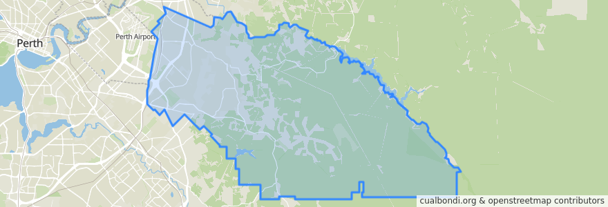
City Of Kalamunda
City Of Kalamunda
Lihat di peta interaktif
Laluan pengangkutan awam
270F Elizabeth Quay Bus Station → High Wycombe Station
270T High Wycombe Station → Elizabeth Quay Bus Station
280F High Wycombe Station → Westfield Carousel
280T Westfield Carousel → High Wycombe Station
293F Redcliffe → High Wycombe
293T High Wycombe → Redcliffe
294F High Wycombe → Foodbank WA
294T Foodbank WA → High Wycombe
Airport Line: Claremont → High Wycombe
Airport Line: High Wycombe → Claremont
Perhentian
Maida Vale Rpad after Myerson Crescent
Berkshire Road before Mandevilla Street
Hawtin Road after Berkshire Road
Abernethy Road before Dubs Close
High Wycombe Station Stand 6
Hawtin Rd After Leschenaultia Wy
Maida Vale Road after Littlefield Road
Hale Road after Hartfield Road
Hawtin Road before Crimson Boulevard
Dundas Road after Musk Court
Berkshire Road after Apricot Street
Berkshire Rd Before Berberis Wy
Abernethy Road before Beyer Place
Hawtin Road after Kent Road
Dundas Road before Kapok Court
Maida Vale Road before Hawtin Road
Hale Road after Anderson Road
Dundas Road before Wittenoom Road
Maida Vale Road after Butcher Road
Hale Road after Dawson Avenue
Abernethy Road after Dubs Close
Hale Road after Sheffield Road
Hale Road after Mallow Way
Dundas Road after Wittenoom Road
Hale Road after Hardey East Road
Hawtin Road after Maud Road
Dundas Road after Musk Court
Maida Vale Road before Milner Road
Berkshire Road before Ashby Close
Hale Road after Woodlupine Court
Tempat menarik
City Of Kalamunda