Login
Star users
Poll
Home
>
United States
>
Utah
>
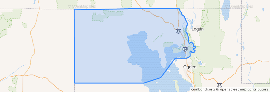
Box Elder County
Box Elder County
See in interactive map
Routes of public transport
UTA Route 630 Brigham City/Ogden (to Brigham City)
UTA Route 630 Brigham City/Ogden (to Ogden)
UTA Route F638 Brigham City/Willard Flex
Places
Brigham City
(3)
Perry
(2)
Willard
(2)
Bear River City
(0)
Corinne
(0)
Deweyville
(0)
Elwood
(0)
Fielding
(0)
Garland
(0)
Honeyville
(0)
Howell
(0)
Mantua
(0)
Plymouth
(0)
Portage
(0)
Snowville
(0)
Tremonton
(0)
Points of interest
Rose A. Young Elementary at Three Mile Creek
The Church of Jesus Christ of Latter-day Saints
Garland
Brigham City
Costa Vida Fresh Mexican Grill
The Church of Jesus Christ of Latter-day Saints
Bridgerland Applied Technology College
Firehouse Pizza
Willard
Portage
The Lodge
The Church of Jesus Christ of Latter-day Saints
The Church of Jesus Christ of Latter-day Saints
Howell
Brigham City Library
Box Elder County
Church of Christ
Plymouth
The Church of Jesus Christ of Latter-day Saints
Fielding
VFW Post
Snowville
The Church of Jesus Christ of Latter-day Saints
Asemblea de Dios
Mantua
La Hermosa Assembly
Subway
Brigham City Bible Church
Christian Reformed Church
Bridgerland College of Cosmetology