Accesso
Utenti preferiti
Sondaggio
Homepage
>
Stati Uniti d'America
>
Utah
>
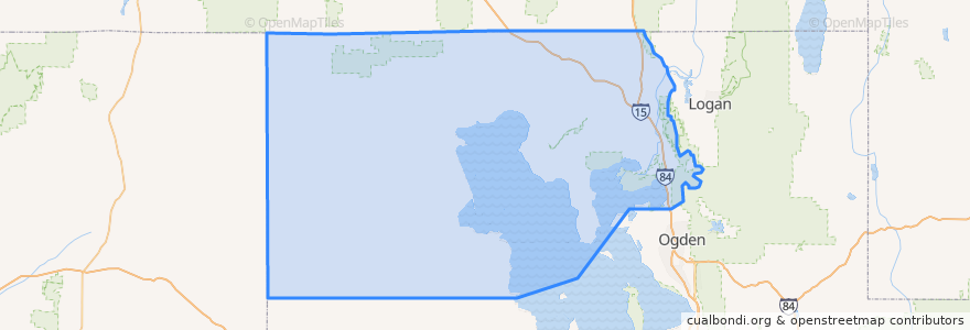
Box Elder County
Box Elder County
Visualizza nella mappa interattiva
Percorsi di trasporto pubblico
UTA Route 630 Brigham City/Ogden (to Brigham City)
UTA Route 630 Brigham City/Ogden (to Ogden)
UTA Route F638 Brigham City/Willard Flex
Posti
Brigham City
(3)
Perry
(2)
Willard
(2)
Bear River City
(0)
Corinne
(0)
Deweyville
(0)
Elwood
(0)
Fielding
(0)
Garland
(0)
Honeyville
(0)
Howell
(0)
Mantua
(0)
Plymouth
(0)
Portage
(0)
Snowville
(0)
Tremonton
(0)
Punti di interesse
Elwood
Willard School
Perry
Utah State University Brigham City
The Church of Jesus Christ of Latter-day Saints
Maddox Take Out Cabin
Aldersgate United Methodist Church
El Toro Viejo
Garland
Snowville
The Church of Jesus Christ of Latter-day Saints
Portage
Police Station
Saint Michaels Episcopal Church
Maddox Family Drive-In
Hunan Village
The Church of Jesus Christ of Latter-day Saints
Costa Vida Fresh Mexican Grill
Tremonton
Rose A. Young Elementary at Three Mile Creek
The Church of Jesus Christ of Latter-day Saints
First Baptist Church
Subway
The Church of Jesus Christ of Latter-day Saints
The Frozen Udder
Asemblea de Dios
The Church of Jesus Christ of Latter-day Saints
Brigham City
Bridgerland College of Cosmetology
The Church of Jesus Christ of Latter-day Saints