Login
Star users
Poll
Home
>
Baltimore
>
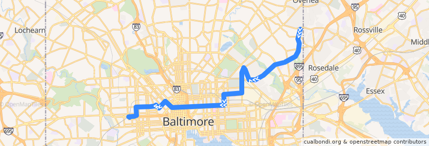
CityLink Pink: West Baltimore
Route
CityLink Pink: West Baltimore
write the first review
See in interactive map
Points of interest near the route
Between Two Buns
Best Pizza Subs Wings & More
All My Children Child Care Center
Saint James Convent
Khun Nine Thai
Staff Only
Michaelangelo's
Saint John Baptist Church
Apostolic Community Fellowship
Baskin-Robbins
Mount Calvary of the Pentecostal Faith Church
Mount Vernon Stable
New Metropolitan Baptist Church
My Father's House and Church Ministries
Mount Hebron Baptist Church
Christs Institute Church
Piazza 27
Saint Wenceslaus School
First Colored Baptist Church
Patrick Henry School
Baltimore
Community Church of Christ
American Buffalo Wings
Beulah Christian Community Church
The Dog House
Kumari
Crêpes by Mina
Mount Vernon Spine & Rehab
Union Baptist Church
Nepal House
Royal Driving School
Grand Central
Downtown Baltimore Child Care / Park Avenue
William H Welch Medical Library
Dear Globe
Little Caesars
Tio Pepe Restaurante
Dunkin' Donuts
Brown Rice
Bring It To Life Ministries
Subway
Evans Temple Church of God in Christ
Paul Laurence Dunbar Middle School
Sojourner Douglas College
City Cafe
Mount Pleasant Christian School
Staff and Oversized
Ceremony Coffee Roasters
Amazing Grace Evangelical Church
Saint Pius Memorial Roman Catholic Church
Poblano Mexican Grill
Good Fortune
Saint Marys Seminary
Saint Andrews Orthodox Presbyterian Church
Bethlehem Christian Day School
Pharmacy
United Baptist Church
Lung Wah
Pacific Carry Out
Church of Our Saviour
Stops:
-76.5729895, 39.306315000000005
-76.5811913, 39.3059487
West Baltimore
-76.5811872, 39.305871200000006
West Baltimore
-76.573032, 39.306311400000006