Ouverture de session
Utilisateurs étoile
Sondage
Accueil
>
Sri Lanka
>
Province de l'Ouest
>
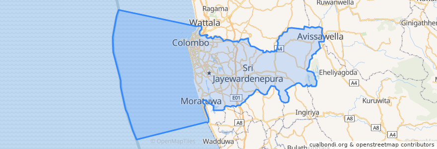
Colombo
Colombo
Voir sur la carte interactive
Itinéraires des transports publics
103 Fort Borella
103 Fort Narahenpita
122 Avissawella
122 Colombo Avissawella
138, Kadawatha Colombo Fort
168 Nugegoda Kotahena
176 Karagampitiya Hettiyawatte
190 Meegoda Pettah
993 Maharagama Malabe
Avissawella - Panawala Road
Bus 101
Coastal Line
Godagama
Gothatuwa - Pettah
Kegalle
Kelani Valley Line
Kelani Valley Line
Kohilawththa - Kollupitiya
Mt. Lavinia - Bakery Junction
Wellawatte → Narahenpita
Endroits
Colombo
(11)
Arrêts
Nawinna
Pannipitiya
Narahenpita
Sigma
79.87685570000001, 6.8861631
79.8662319, 6.8767474
Narahenpita
Randeniya Car Accessories
Pamankada Halt
Cotta Road
Manning Place halt
Colombo Fort
Nugegoda
Maharagama
Maradana
79.87688270000001, 6.8877192
Kottawa
Kirulapona Market
Kirulapona
Udahamulla
Baseline Road
Malapalla
Points d'interêts
Bank of Ceylon
Il Gelato
People's Bank
St. Margerets convent
John De Silva
Dr. Ravimal Galappaththi
Vidyadaya Pirivena
Commercial Bank of Ceylon
Sampath Super Branch
Hotel Nippon
NTB Nawam Mawatha
Weerasiri Cafe
Eat Rite
HNB
Peoples Bank ATM
Dharmapala Vidyalaya
Public Lavatory
Masjidul Akbar Jumma Mosque Slave Island
Panchikawatte Masjid
Sive Subramaniya Kovil Slave Island
Bao House
Commercial Bank of Ceylon
Lumbini Monastery
Colombo public library event venue
Wekanda Pre School
Botanik Bistro & Roof Top Bar
Panorama
Monsoon Colombo
Iko Tei
DFCC Bank