Oturum aç
Yıldız kullanıcılar
Anket
anasayfa
>
Avustralya
>
New South Wales
>
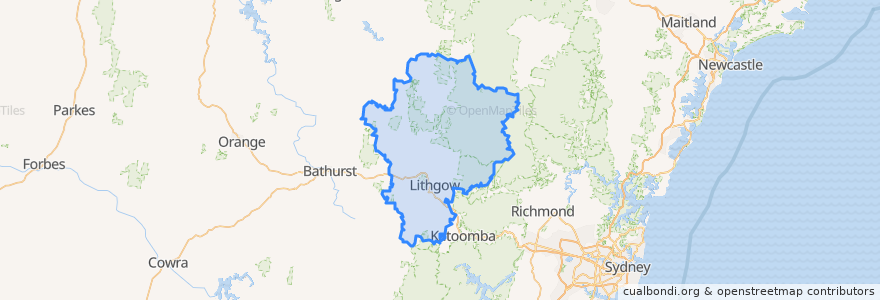
Lithgow City Council
Lithgow City Council
Etkileşimli haritada görüntüle
Toplu taşıma yolları
Blue Mountains Line
Blue Mountains Line
Broken Hill Xplorer
Broken Hill Xplorer
Dubbo XPT
Dubbo XPT
Main Western Line
Train Indian Pacific
Train Indian Pacific
Durur
Tarana
Zig Zag, Platform 2
Lithgow, Platform 2
Zig Zag, Platform 1
Rydal
Lithgow, Platform 1
İlgi noktaları
St Patrick's Catholic Church
Memory Lane Bistro
Bowenfels Post Office
Subway
Commercial Hotel
Blue Sky Restaurant
Crib Room Restaurant
Pied Piper Preschool
Tattersalls Hotel
JO’s crossing
St Paul's Anglican Church
NRMA Fast Charger
Lansdowne Hotel
Wallerawang Advantage Pharmacy
The Fast Fox
Lithgow Palace Chinese Restaurant
Pizza Hut
Frankie's Restaurant & Bar Lithgow
Wallerawang Service Station
Lithgow Golf Club Bistro
Lithgow Veterinary Hospital
Eskbank Surgery
Domino's
Enhance
Mobil
Wallerawang Library
Patiala Shahi
Smiles to you Lithgow Denture Clinic
Royal Hotel / Top Pub
SIXT