Log masuk
Pengguna bintang
Undian
Laman utama
>
Amerika Syarikat
>
Colorado
>
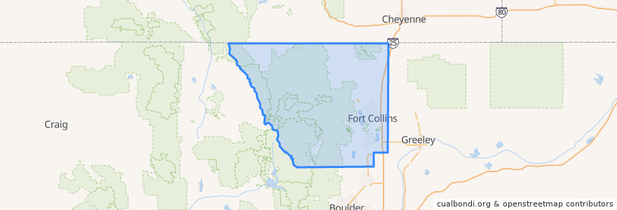
Larimer County
Larimer County
Lihat di peta interaktif
Laluan pengangkutan awam
12 NB
14 EB
16 EB
18 SB
19 SB
32 Loop
33 EB
33 WB
34 NB
Tempat
Fort Collins
(9)
Berthoud
(0)
Berthoud
(0)
Estes Park
(0)
Estes Park
(0)
Estes Park
(0)
Laporte
(0)
Loveland
(0)
Loveland
(0)
Timnath
(0)
Wellington
(0)
Wellington
(0)
Perhentian
Horsetooth & MAX
Horsetooth & Stover
Horsetooth & Kingsley
Midpoint Drive
Harmony & McMurray
Prospect & Welch
Horsetooth & Kunz
Elizabeth & Constitution
Harmony & Hinsdale
Shields & Prospect
Lady Moon & Harmony
Prospect and Northbrook
Olive & Peterson
CSU Foothills Campus
John Deere and Frontage
Lincoln & Air Park
Prospect and Fuqua
Elizabeth & Whedbee
Horsetooth & Automation
Elizabeth & Timber
Plum & Bluebell
Taft Hill & Westfield
Shields & Stuart
-105.08041650000001, 40.5189192
Elizabeth and Timber
Harmony & Starflower
Horsetooth & Manhattan
Whedbee & Laurel
Olive & Peterson
Harmony & Corbett
Tempat menarik
Barking Beagle's Little Free Library
La Piadina
Silver Mine Subs
Wells Fargo
Five Guys
7-Eleven
Pizza Hut
Library - Council Tree Branch
Pho Duy
Town Pump
Beau Jo's Pizza
Old Town Station Fort Collins Post Office
Choice City Butcher and Deli
Noodles & Company
Metered Parking
LuLu Asian Bistro
Subway
Petra Grill
Mad Greens
The Crooked Cup
Good Feet
Mama Roni's Pizza
Happy Lucky's Teahouse
Berthoud
Wellington
Five Guys
Moe's Original Bar B Que
Fort Collins
Shell
Spring Creek Dental